Panoply 5.3.4 freeware

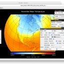
Panoply is an utility that enable user to plot raster image. Depending on the data, it can draw global longitude-latitude images or pole-to-pole latitude-vertical images.Panoply is a cross-platform application which plots geo-gridded arrays from netCDF, HDF and GRIB datasets. ...

Author Robert B. Schmunk
Released 2024-03-29
Filesize 34.00 MB
Downloads 488
OS Windows XP, Windows Vista, Windows Vista x64, Windows 7, Windows 7 x64, Windows 8, Windows 8 x64, Windows 10, Windows 10 x64, Windows 11
Installation Instal And Uninstall
Keywords plot raster image, longitude image, pole-to-pole image, raster image, rasterize, raster
Users' rating
(20 rating)
PanoplyCADWindows XP, Windows Vista, Windows Vista x64, Windows 7, Windows 7 x64, Windows 8, Windows 8 x64, Windows 10, Windows 10 x64, Windows 11
Panoply - browse Freeware Download Notice

Panoply Free Download - we do not host any Panoply torrent files or links of Panoply on rapidshare.com, depositfiles.com, megaupload.com etc. All Panoply download links are direct Panoply download from publisher site or their selected mirrors.

Panoply freeware - The Latest User Reviews
Panoply freeware - The Latest Versions History
5.3.4 Mar 29, 2024 New Release
5.3.3 Mar 1, 2024 New Release
5.3.2 Jan 31, 2024 New Release

Most popular CAD freeware downloads

Panoply for Mac

5.3.4 freeware download

... is organized into multiple tabs that help you browse between datasets and catalogues, to adjust the scale range, to customize labels, vectors, to overlay masks, ...

QGIS for Mac

3.36.1 freeware download

... vector, raster, and database formats and lets you browse and create map data on your computer. QGIS supports many common spatial data formats (e.g. ...

QGIS for Linux

3.36.1 freeware download

... vector, raster, and database formats and lets you browse and create map data on your computer. QGIS supports many common spatial data formats (e.g. ...

Panoply

5.3.4 freeware download

... imported in the working environment using the built-in browse button or drag-and-drop support. You are allowed to add data from one of the datasets mentioned ...

QGIS

3.36.1 freeware download

... vector, raster, and database formats and lets you browse and create map data on your computer. QGIS supports many common spatial data formats (e.g. ...

primesieve

12.1 freeware download

... increase instruction-level parallelism Parallelized (multi-threaded) using OpenMP To browse the latest primesieve source code online visit the 'Source' tab. ...

Gephi

0.10.1 freeware download

... files · Use the Data Table view to browse and edit data Modular: · Gephi 0.7 architecture is modular and therefore allows developers to ...

Gephi for Linux

0.10.1 freeware download

... files · Use the Data Table view to browse and edit data Modular: · Gephi 0.7 architecture is modular and therefore allows developers to ...

Gephi for Mac OS X

0.10.1 freeware download

... files · Use the Data Table view to browse and edit data Modular: · Gephi 0.7 architecture is modular and therefore allows developers to ...

primesieve x64

12.1 freeware download

... increase instruction-level parallelism Parallelized (multi-threaded) using OpenMP To browse the latest primesieve source code online visit the 'Source' tab. ...