TNTmips for Mac OS X 20240111 freeware

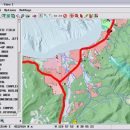
TNTmips is a geospatial image processing tool that allows you to analyze and modify GIS images. It is a professional application that can handle desktop cartography, electronic atlas preparation and spatial database management. ...

Author MicroImages, Inc.
Released 2024-01-11
Filesize 87.90 MB
Downloads 473
OS Mac OS X
Installation Instal And Uninstall
Keywords GIS data analysis, analyze geodetic data, edit GIS dataset, GIS, dataset, editor, analysis, mac os, TNTmips for mac, TNTgis for mac, TNTedit
Users' rating
(21 rating)
TNTmips for Mac OS XCADMac OS X
TNTmips for Mac OS X - digital Freeware Download Notice

TNTmips for Mac OS X Free Download - we do not host any TNTmips for Mac OS X torrent files or links of TNTmips for Mac OS X on rapidshare.com, depositfiles.com, megaupload.com etc. All TNTmips for Mac OS X download links are direct TNTmips for Mac OS X download from publisher site or their selected mirrors.

TNTmips for Mac OS X freeware - The Latest User Reviews
TNTmips for Mac OS X freeware - The Latest Versions History
20240111 Jan 11, 2024 New Release
20230323 Mar 23, 2023 New Release
2022 B202212 Dec 7, 2022 New Release

Most popular CAD freeware downloads

TNTmips for Mac OS X

20240111 freeware download

... efficient Surface Fitting, Contouring, and Triangulation operations produce Digital Elevation Model rasters (DEMs), contour lines, and triangulated irregular networks (TINs), respectively. TNTgis software on ...

QGIS for Mac

3.36.1 freeware download

... and graduated) · Display raster data such as digital elevation models, aerial photography or landsat imagery · Change raster symbology (grayscale, pseudocolor and multiband RGB) ...

QGIS for Linux

3.36.1 freeware download

... and graduated) · Display raster data such as digital elevation models, aerial photography or landsat imagery · Change raster symbology (grayscale, pseudocolor and multiband RGB) ...

TNTmips

20240404 freeware download

... efficient Surface Fitting, Contouring, and Triangulation operations produce Digital Elevation Model rasters (DEMs), contour lines, and triangulated irregular networks (TINs), respectively ... ...

QGIS

3.36.1 freeware download

... and graduated) · Display raster data such as digital elevation models, aerial photography or landsat imagery · Change raster symbology (grayscale, pseudocolor and multiband RGB) ...

LogicCircuit

2.24.02.27 freeware download

... open source educational software for designing and simulating digital logic circuits. Intuitive graphical user interface, allows you to create unrestricted circuit hierarchy with multi bit ...

PicoScope

7.1.21 freeware download

... oscilloscope – plot one channel again another · Digital persistence – spot glitches the easy way · Math channels – invert, add, subtract, multiply and ...

BrickUtils Portable

0.1.3.0 freeware download

... a simple utility for builders that uses LEGO® Digital Designer™ or LDraw-compatible CAD for designing models. The main problem that BrickUtils tries to solve is ...

AutoCAD OwnerGuard

12.9.1 freeware download

... sensitive drawings security, protection, usage limitations, distribution and digital rights management. AutoCAD OwnerGuard will bring the maximum protection an ease of use to you and ...

Qucs

0.0.19 freeware download

Qucs is a circuit simulator with graphical user interface. The software aims to support all kinds of circuit simulation types, e.g. DC, AC, S-parameter, Harmonic Balance ...