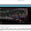
Bootgraph CAD Viewer 6.1 freeware

FREE CAD DWG viewer. Key feature highlights: 1. Fast DWG viewer 2. Smart QS calculation: 3. The perfect integration of CAD and Excel: 4. Quick interaction of engineering information ...

Author Xiaotu Technology Co., Ltd
Released 2023-02-01
Filesize 50.02 MB
Downloads 151
OS Win2000, Windows XP, Windows 7 x32, Windows 7 x64, Windows 8, Windows 10, WinServer, WinOther, Windows Vista, Windows Vista x64
Installation Install and Uninstall
Keywords FREE CAD, FREE AutoCAD
Users' rating
(5 rating)
Bootgraph CAD ViewerCADWin2000, Windows XP, Windows 7 x32, Windows 7 x64, Windows 8, Windows 10, WinServer, WinOther, Windows Vista, Windows Vista x64
Bootgraph CAD Viewer - map viewer Freeware Download Notice

Bootgraph CAD Viewer Free Download - we do not host any Bootgraph CAD Viewer torrent files or links of Bootgraph CAD Viewer on rapidshare.com, depositfiles.com, megaupload.com etc. All Bootgraph CAD Viewer download links are direct Bootgraph CAD Viewer download from publisher site or their selected mirrors.

Bootgraph CAD Viewer freeware - The Latest User Reviews
Bootgraph CAD Viewer freeware - The Latest Versions History
6.1 Feb 1, 2023 New Release V6.1 is the flagship product new release for the New Year. It has 12 new function modules, 3 performance optimization items, 14 function optimization items, and 12 bug fixes. Compared with the previous version, it has a qualitative leap and greatly improved customer experience.
5.0 Jul 28, 2022 New Release More than 10 new features and more than 20 funtional enhancements for Bootgraph CAD Viewer V5.0 Version.
4.0 Oct 10, 2021 New Release Bootgraph CAD Viewer is a free CAD tool. It supports CAD calculation, continuous measurement, CAD base drawing gray display, table calculation, graphic recognition CAD block, length measurement, area measurement, CAD version conversion. Not only a mini CAD viewing tool, but also a powerful CAD assis

Most popular CAD freeware downloads

Panoply for Mac

5.3.4 freeware download

... one plot by differencing, summing or averaging. Create map plots of trajectory data based on the CF ... Plot lon-lat data on a global or regional map using any of over 200 map projections or ...

QGIS for Mac

3.36.1 freeware download

... database formats and lets you browse and create map data on your computer. QGIS supports many ... initial goal was to provide a GIS data viewer. QGIS has reached that point in its evolution ...

QGIS for Linux

3.36.1 freeware download

... database formats and lets you browse and create map data on your computer. QGIS supports many ... initial goal was to provide a GIS data viewer. QGIS has reached that point in its evolution ...

QGIS

3.36.1 freeware download

... database formats and lets you browse and create map data on your computer. QGIS supports many ... initial goal was to provide a GIS data viewer. QGIS has reached that point in its evolution ...

Panoply

5.3.4 freeware download

... Plot lon-lat data on a global or regional map (using any of over 75 map projections) or make a zonal average lineplot. * ... PDF or PostScript graphics files. * Export lon-lat map plots in KMZ format. ...

CueMol

2.2.3.442 freeware download

... format), MSMS surface data, and GRASP electrostatic potential map. ...

TNTatlas for Mac OS X

2023 B20230323 freeware download

TNTatlas is a powerful free geodata viewer that lets you publish and distribute your maps ... — from a single geodata file to complex map layouts prepared using TNTmips. TNTatlas lets you display ...

DX Central

2.20 freeware download

... different views of the sun · Doppler MDI map of the sun's far side · D-Region X-Ray absorption map from NOAA SWPC · Updates automatically every 10 ...

DX Central for Linux

2.20 freeware download

... different views of the sun · Doppler MDI map of the sun's far side · D-Region X-Ray absorption map from NOAA SWPC · Updates automatically every 10 ...

Thuban for Windows

1.2.2 freeware download

Thuban is an interactive geographic data viewer (GIS viewer) which features methods to visualize, explore, and analyze ... information. Thuban is an Interactive Geographic Data Viewer with the following features: # Vector Data ...