TNTmips for Mac OS X 20240111 freeware

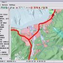
TNTmips is a geospatial image processing tool that allows you to analyze and modify GIS images. It is a professional application that can handle desktop cartography, electronic atlas preparation and spatial database management. ...

Author MicroImages, Inc.
Released 2024-01-11
Filesize 87.90 MB
Downloads 474
OS Mac OS X
Installation Instal And Uninstall
Keywords GIS data analysis, analyze geodetic data, edit GIS dataset, GIS, dataset, editor, analysis, mac os, TNTmips for mac, TNTgis for mac, TNTedit
Users' rating
(21 rating)
TNTmips for Mac OS XCADMac OS X
TNTmips for Mac OS X - system software Freeware Download Notice

TNTmips for Mac OS X Free Download - we do not host any TNTmips for Mac OS X torrent files or links of TNTmips for Mac OS X on rapidshare.com, depositfiles.com, megaupload.com etc. All TNTmips for Mac OS X download links are direct TNTmips for Mac OS X download from publisher site or their selected mirrors.

TNTmips for Mac OS X freeware - The Latest User Reviews
TNTmips for Mac OS X freeware - The Latest Versions History
20240111 Jan 11, 2024 New Release
20230323 Mar 23, 2023 New Release
2022 B202212 Dec 7, 2022 New Release

Most popular CAD freeware downloads

TNTmips for Mac OS X

20240111 freeware download

TNTmips for Mac is a complete Geographic Information System (GIS) that lets you work with virtually any ... data types and a multitude of Coordinate Reference Systems. Include layers in a wide variety of external ...

FilterPro Desktop

3.1.0.23446 freeware download

FilterPro v3.1 active filter design software offers a new and improved user interface and ... feedback op amps. FilterPro v3.1 active filter design software is free and available for download now. ...

QGIS for Mac

3.36.1 freeware download

... proud to be itself Free and Open Source Software (FOSS). QGIS supports vector, raster, and database formats and lets you browse and create map ...

QGIS for Linux

3.36.1 freeware download

... proud to be itself Free and Open Source Software (FOSS). QGIS supports vector, raster, and database formats and lets you browse and create map ...

ProfiCAD

12.4.4 freeware download

... just drag symbols onto the drawing low system requirements - runs on any PC with Windows 2000 and higher supports Unicode - can ...

TNTmips

20240404 freeware download

TNTmips software is a complete Geographic Information System (GIS) that lets you work with virtually any ... data types and a multitude of Coordinate Reference Systems. Include layers in a wide variety of external ...

QGIS

3.36.1 freeware download

... proud to be itself Free and Open Source Software (FOSS). QGIS supports vector, raster, and database formats and lets you browse and create map ...

Euler Math Toolbox

2024-01-14 freeware download

The Euler Mathematical Toolbox is a software written and maintained by R. Grothmann, associate professor ... with Euler through pipes. It remains a separated system. However, there are various interactions between Euler and ...

Elshayal Smart

23.02 freeware download

Elshayal Smart is the first Arabian GIS software that is completely developed by Arabian developers team and independent of any commercial software package. Download Maps from Google Earth, and ...

GeoMapApp

3.7.1 freeware download

... analysis for data types that typically require specialist software. Examples include seismic reflection profiles and geodetic velocity ... maintained as part of the Marine Geoscience Data System (MGDS) at Lamont-Doherty Earth Observatory of Columbia University. ...