Bootgraph CAD Viewer 6.1 freeware

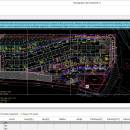
FREE CAD DWG viewer. Key feature highlights: 1. Fast DWG viewer 2. Smart QS calculation: 3. The perfect integration of CAD and Excel: 4. Quick interaction of engineering information ...

Author Xiaotu Technology Co., Ltd
Released 2023-02-01
Filesize 50.02 MB
Downloads 151
OS Win2000, Windows XP, Windows 7 x32, Windows 7 x64, Windows 8, Windows 10, WinServer, WinOther, Windows Vista, Windows Vista x64
Installation Install and Uninstall
Keywords FREE CAD, FREE AutoCAD
Users' rating
(5 rating)
Bootgraph CAD ViewerCADWin2000, Windows XP, Windows 7 x32, Windows 7 x64, Windows 8, Windows 10, WinServer, WinOther, Windows Vista, Windows Vista x64
Bootgraph CAD Viewer - view map Freeware Download Notice

Bootgraph CAD Viewer Free Download - we do not host any Bootgraph CAD Viewer torrent files or links of Bootgraph CAD Viewer on rapidshare.com, depositfiles.com, megaupload.com etc. All Bootgraph CAD Viewer download links are direct Bootgraph CAD Viewer download from publisher site or their selected mirrors.

Bootgraph CAD Viewer freeware - The Latest User Reviews
Bootgraph CAD Viewer freeware - The Latest Versions History
6.1 Feb 1, 2023 New Release V6.1 is the flagship product new release for the New Year. It has 12 new function modules, 3 performance optimization items, 14 function optimization items, and 12 bug fixes. Compared with the previous version, it has a qualitative leap and greatly improved customer experience.
5.0 Jul 28, 2022 New Release More than 10 new features and more than 20 funtional enhancements for Bootgraph CAD Viewer V5.0 Version.
4.0 Oct 10, 2021 New Release Bootgraph CAD Viewer is a free CAD tool. It supports CAD calculation, continuous measurement, CAD base drawing gray display, table calculation, graphic recognition CAD block, length measurement, area measurement, CAD version conversion. Not only a mini CAD viewing tool, but also a powerful CAD assis

Most popular CAD freeware downloads

Panoply for Mac

5.3.4 freeware download

... GRIB datasets. Panoply is designed to help you view and process the data included in netCDF, HDF, ... one plot by differencing, summing or averaging. Create map plots of trajectory data based on the CF ...

TNTmips for Mac OS X

20240111 freeware download

... of geospatial data including imagery, terrain surfaces, and map data with associated database attributes. It provides all the tools you need to view, create, edit, georeference, interpret, and publish any type ...

QGIS for Mac

3.36.1 freeware download

... database formats and lets you browse and create map data on your computer. QGIS supports many ... initial goal was to provide a GIS data viewer. QGIS has reached that point in its evolution ...

QGIS for Linux

3.36.1 freeware download

... database formats and lets you browse and create map data on your computer. QGIS supports many ... initial goal was to provide a GIS data viewer. QGIS has reached that point in its evolution ...

TNTmips

20240404 freeware download

... of geospatial data including imagery, terrain surfaces, and map data with associated database attributes. It provides all the tools you need to view, create, edit, georeference, interpret, and publish any type ...

QGIS

3.36.1 freeware download

... database formats and lets you browse and create map data on your computer. QGIS supports many ... initial goal was to provide a GIS data viewer. QGIS has reached that point in its evolution ...

Panoply

5.3.4 freeware download

... help you plot raster images. It lets you view photos created with NetCDF, HDF, GEMPACK, GRIB and ... Plot lon-lat data on a global or regional map (using any of over 75 map projections) or ...

GetNexrad

4.4.2 freeware download

GetNexrad 3.5.2 is a tool used to view real-time area radar rainfall loops and to generate ... 0.5 dBZ long range higher resolution images. Goggle Map overlays, real-time surface observations, and a web browser ...

Elshayal Smart

23.02 freeware download

... Earth, and Trace & save GPS route and View and Rectify Raster Images gif, jpg, bmp and ... query builder, build network, find shortest path, print map, save map image, copy map image to clipboard, ...

CueMol

2.2.3.442 freeware download

... format), MSMS surface data, and GRASP electrostatic potential map. ...