QGIS for Mac 3.36.1 freeware

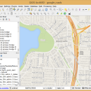
QGIS supports vector, raster, and database formats and lets you browse and create map data ... computer.
QGIS supports many common spatial data formats (e.g. ESRI ShapeFile, geotiff). QGIS supports plugins to do things like display tracks from your GPS.
QGIS aims to be an easy to use GIS, providing common functions and features. The initial goal was to provide a GIS data viewer. ...

Author Gary Sherman
Released 2024-03-26
Filesize 1600.00 MB
Downloads 820
OS Mac OS X
Installation Instal And Uninstall
Keywords geographic information system, map creator, map viewer, GIS, geographic information, create, QGIS for Mac
Users' rating
(36 rating)
QGIS for MacCADMac OS X
QGIS for Mac - all formats Freeware Download Notice

QGIS for Mac Free Download - we do not host any QGIS for Mac torrent files or links of QGIS for Mac on rapidshare.com, depositfiles.com, megaupload.com etc. All QGIS for Mac download links are direct QGIS for Mac download from publisher site or their selected mirrors.

QGIS for Mac freeware - The Latest User Reviews
QGIS for Mac freeware - The Latest Versions History
3.36.1 Mar 26, 2024 New Release
3.36.2 Apr 25, 2024 New Release
3.36.1 Mar 26, 2024 New Release

Most popular CAD freeware downloads

ZWCAD Viewer

2017 freeware download

... With ZWCAD Viewer, drawings can be viewed in all kinds of frequently used file formats like dwg, dwf, dwfx, dxf and dwt. Handy ... coordinates on the drawings. Its property palette displays all details and it allows file comparison and differences ...

DipTrace Free

4.3.0.0 freeware download

... keeps the entire PCB project in sync at all design stages. Designing a component/footprint library is fast ... libraries with other EDA and CAD packages. Output formats: DXF, Gerber, ODB++, Gerber X2, IPC-D-356A, N/C Drill, ...

TinyCAD

3.00.04 freeware download

... files, they are the open-source equivilent of GIFs. All modern web browsers and operating systems support PNG ... program. TinyCAD supports several different PCB net-list formats. Simply export the net-list from TinyCAD and import ...

Pro Yacht

1.0.0.1 freeware download

... the introduction of new realisation code to manage all information extracted from surfaces. While the hull transformation ... introduced covering Tribon/AVEVA Marine, Seasafe and Napa data formats. ...

GstarCAD MC

3.3.1 freeware download

... cross-platform CAD software that meets designers’ demands in all kinds of situation, and fully compatible with DWG, ... mobile CAD experience. View, Edit, Create & Share all your CAD drawings, synchronize to cloud from multiple ...

VEGA ZZ

3.2.3.28 freeware download

... CPK, ball & stick, stick, trace and tube. All representations can be mixed thanks to the selection ... type of colors. Multiple surface management. All 3D object can be managed with mouse, joystick ...

TNTmips

20240404 freeware download

... map data with associated database attributes. It provides all the tools you need to view, create, edit, ... Include layers in a wide variety of external formats without importing. Overlay your geodata on Bing Maps ...

QGIS for Linux

3.36.1 freeware download

... (FOSS). QGIS supports vector, raster, and database formats and lets you browse and create map data ... computer. QGIS supports many common spatial data formats (e.g. ESRI ShapeFile, geotiff). QGIS supports plugins to ...

SDMetrics

2.5 freeware download

... measures covering structural properties of design elements from all UML1.x and UML2.0/2.1 diagram types. · Measure all the import design attributes - size, coupling, complexity ...

Geneious Basic

6.0.4 freeware download

... for manually cutting and pasting sequences. It contains all core bioinformatics functions in an integrated workflow. ... Import and export Newick, Nexus, FASTA and Endnote formats. Import PDF, 3D Structures, Vector NTI, Chromatograms, DNA ...