Navigation:
OzGIS 14.7.0.7 freeware
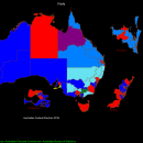
... extensive system for the analysis and display of geographically referenced data. About 150 menus provide an enormous ... of options The system can be used to analyze socio-economic and demographic data produced by censuses and surveys and to support management decisions associated with for example marketing, sales, site and personnel location, and advertising. Other spatial data such as environmental data can be displayed. ...
| Author | OzGIS |
| Released | 2021-09-17 |
| Filesize | 313 kB |
| Downloads | 773 |
| OS | Win2000, Windows XP, Windows 7 x32, Windows 7 x64, Windows 8, Windows 10, WinServer, WinOther, Windows Vista, Windows Vista x64 |
| Installation | Install Only |
| Keywords | mapping, census, territory, GIS |
| Users' rating (25 rating) |
OzGIS Free Download - we do not host any OzGIS torrent files or links of OzGIS on rapidshare.com, depositfiles.com, megaupload.com etc. All OzGIS download links are direct OzGIS download from publisher site or their selected mirrors.
| 14.7.0.7 | Sep 17, 2021 | Major Update | Improved Release |
| 14.7.0.6 | Sep 17, 2021 | Major Update | Improved Release |
| 14.7.0.5 | Sep 17, 2021 | Major Update | Improved Release |