- Freeware
- - Home & Hobby
- - Other
- - Panoply
Panoply 5.6.1 freeware
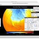
... developed by Robert B. Schmunk, is a powerful data visualization tool designed for geoscientific data analysis. It allows users to effortlessly explore, visualize, and analyze multidimensional datasets, making it an invaluable resource for researchers and ... variety of file formats, enabling seamless integration of data from diverse sources. Users can create high-quality graphs and maps, facilitating better insights into com ... ...
| Author | Robert B. Schmunk |
| Released | 2025-05-09 |
| Filesize | 45.20 MB |
| Downloads | 1036 |
| OS | Windows 11, Windows Server 2019, Windows Server 2016, Windows 10 64 bit, Windows Server 2012 R2, Windows Server 2012, Windows 8 64 bit, Windows 7 64 bit |
| Installation | Instal And Uninstall |
| Keywords | Panoply, Plot Raster Image, Geo, Map, Longitude |
| Users' rating (39 rating) |
Panoply Free Download - we do not host any Panoply torrent files or links of Panoply on rapidshare.com, depositfiles.com, megaupload.com etc. All Panoply download links are direct Panoply download from publisher site or their selected mirrors.
| 5.6.1 | May 9, 2025 | New Release | Open and save filechoosers retain more state info between uses during session. Watch out for units strings that use a double asterisk to represent a following exponent. Bugfix: Small default buffer caused a lot of overhead downloading remote datasets. Library: Updated netCDF-Java to v. 5.5.4 (snapshot 3/27). |
| 5.6.0 | Apr 1, 2025 | New Release | Open and save filechoosers retain more state info between uses during session. Watch out for units strings that use a double asterisk to represent a following exponent. Bugfix: Small default buffer caused a lot of overhead downloading remote datasets. Library: Updated netCDF-Java to v. 5.5.4 (snapshot 3/27). |
| 5.5.5 | Nov 9, 2024 | New Release | Open and save filechoosers retain more state info between uses during session. Watch out for units strings that use a double asterisk to represent a following exponent. Bugfix: Small default buffer caused a lot of overhead downloading remote datasets. Library: Updated netCDF-Java to v. 5.5.4 (snapshot 3/27). |