wxGIS Portable 0.4.1 freeware

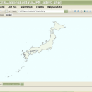
... systems in folders. It also includes a vector file export utility and a tool for correcting the orthographic data from raster TIFF files. ...

Author Dmitry Barishnikov
Released 2012-11-15
Filesize 9.70 MB
Downloads 368
OS Windows XP, Windows Vista, Windows Vista x64, Windows 7, Windows 7 x64
Installation Instal And Uninstall
Keywords GIS catalog, manage geography data, geographic coordinate system, manage, catalog, geography
Users' rating
(9 rating)
wxGIS PortableCADWindows XP, Windows Vista, Windows Vista x64, Windows 7, Windows 7 x64
wxGIS Portable - file data Freeware Download Notice

wxGIS Portable Free Download - we do not host any wxGIS Portable torrent files or links of wxGIS Portable on rapidshare.com, depositfiles.com, megaupload.com etc. All wxGIS Portable download links are direct wxGIS Portable download from publisher site or their selected mirrors.

wxGIS Portable freeware - The Latest User Reviews
wxGIS Portable freeware - The Latest Versions History
0.4.1 Nov 15, 2012 New Release · The DEM interpolation switch (bilinear or cubic) in orthocorrect tool
· Russian interface translation
· Rename item support
· Automatic rename output files in batch export
· The ortho-correction tool become more accurate and speedy

Most popular CAD freeware downloads

TNTatlas

2024 B20240606 freeware download

... you publish and distribute your maps and geospatial data — from a single geodata file to complex map layouts prepared using TNTmips. TNTatlas ... massive sized geodata and will directly display numerous file formats including shapefiles, GeoTIFF, JP2, PNG, MrSID, DXF, ...

QGIS for Mac

3.36.1 freeware download

... Software (FOSS). QGIS supports vector, raster, and database formats and lets you browse and create map data on your computer. QGIS supports many common ...

TNTatlas for Mac OS X

2024 B20240508 freeware download

... you publish and distribute your maps and geospatial data — from a single geodata file to complex map layouts prepared using TNTmips. TNTatlas ... massive sized geodata and will directly display numerous file formats including shapefiles, GeoTIFF, JP2, PNG, MrSID, DXF, ...

QFitsView

8.6 freeware download

... is a robust and versatile astronomical imaging and data visualization software that has become an indispensable tool ... Designed to handle the complex demands of astronomical data analysis, DS9 offers a comprehensive suite of features ...

QGIS for Linux

3.36.1 freeware download

... Software (FOSS). QGIS supports vector, raster, and database formats and lets you browse and create map data on your computer. QGIS supports many common ...

SearchGUI for Mac and Linux

4.3.9 freeware download

... DirecTag. To start using SearchGUI, unzip the downloaded file, and double-click the SearchGUI-X.Y.Z.jar file. No additional installation required! The main purpose of ...

TNTmips

20240404 freeware download

... you work with virtually any type of geospatial data including imagery, terrain surfaces, and map data with associated database attributes. It provides all the tools you need ...

QGIS

3.36.1 freeware download

... Software (FOSS). QGIS supports vector, raster, and database formats and lets you browse and create map data on your computer. QGIS supports many common ...

FilterPro Desktop

3.1.0.23446 freeware download

... component values; and view and export filter performance data to Excel. FilterPro active filter design ... filters now accounts for passband ripple Supports design file migration from FilterPro v2 so that designs created ...

MagicPlot Student for Linux

2.9.3 freeware download

... is a handy tool for scientific and engineer data processing, plotting and nonlinear fitting. MagicPlot is powerful ... and consistent. Advantages: * Compact: Single file ~2 MB * Multilevel undo function for all ...