Navigation:
- Freeware
- - Graphic Apps
- - CAD
- - wxGIS
wxGIS 0.2.0 freeware
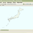
... that is able to store the geographic coordinate systems in folders. It also includes a vector file export utility and a tool for correcting the orthographic data from raster TIFF files. ...
| Author | Dmitry Barishnikov |
| Released | 2012-11-15 |
| Filesize | 9.70 MB |
| Downloads | 417 |
| OS | Windows XP, Windows Vista, Windows Vista x64, Windows 7, Windows 7 x64 |
| Installation | Instal And Uninstall |
| Keywords | GIS catalog, manage geography data, geographic coordinate system, manage, catalog, geography |
| Users' rating (13 rating) |
wxGIS Free Download - we do not host any wxGIS torrent files or links of wxGIS on rapidshare.com, depositfiles.com, megaupload.com etc. All wxGIS download links are direct wxGIS download from publisher site or their selected mirrors.
| 0.2.0 | Nov 15, 2012 | New Release | · The DEM interpolation switch (bilinear or cubic) in orthocorrect tool · Russian interface translation · Rename item support · Automatic rename output files in batch export · The ortho-correction tool become more accurate and speedy |


