- Freeware
- - Home & Hobby
- - Other
- - MyTourbook
MyTourbook 25.6.0 freeware
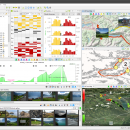
MyTourbook, developed by Wolfgang Schramm, is a powerful open-source software designed for outdoor enthusiasts and fitness aficionados. It enables users to analyze and visualize their tour data, offering comprehensive features like route planning, performance tracking, and detailed statistics. With support for various GPS devices and formats, MyTourbook caters to cyclists, hikers, and runners alike. Its intuitive interface and customizable options make it an essential tool for anyone looking to ... ...
| Author | Wolfgang Schramm |
| Released | 2025-06-19 |
| Filesize | 153.00 MB |
| Downloads | 1616 |
| OS | Windows 11, Windows 10 64 bit, Windows 8 64 bit, Windows 7 64 bit |
| Installation | Instal And Uninstall |
| Keywords | Analyze Tour, Tour, Map, Route, Analyze |
| Users' rating (35 rating) |
MyTourbook Free Download - we do not host any MyTourbook torrent files or links of MyTourbook on rapidshare.com, depositfiles.com, megaupload.com etc. All MyTourbook download links are direct MyTourbook download from publisher site or their selected mirrors.
| 25.6.0 | Jun 19, 2025 | New Release | New / Improvements: Fit Import: Import distance values for swimming to display #1485 Speed graph in the tour chart Distance values in different locations Tour Filter: Duplicate filter property, this makes it easier to create a similar filter #1487 Tour Info Tooltip (Frederic): New fields: Elapsed time at night and during the day for tours that also happen during the night Tour Nutrition (Frederic): Support for the carbohydrates New button to update the nutrition facts of (a) product(s) Edit an existing custom nutrition product Add duplicated products when they are contained in a beverage container 2D Map Photos: Photo Tour: Relocate a photo geo position with the mouse Replace photo geo position with its default position Crop photo with fixed sizes #1494 Set tonality: Adjust tonality values with slider controls Copy and paste from one photo to another Draw under- and overexposed values with a different color in the histogram Tour Chart: Visualize positioned photos with a different photo point color Tour Editor: Remove photo geo position Delete time slices: Added option to adjust the tour start time when pressing the DEL key New context menu action: Delete time slices and adjust tour start time and keep other values Display tour date in the column "Daytime" when the time is on a different day than the tour start, this can happen when a photo tour is created Edit power values in #1492: Time slice viewer Time slice replace/offset dialog Positionable Slideouts: Reset slideout position by pressing Ctrl when the action is selected Changes: 2D Map: Replaced actions to set tour start/end positions #1457 with #1488 When creating a photo tour, a time slice is created for each photo which is positioned slightly different than other photos when the first position is set |
| 24.11.0 | Oct 30, 2024 | New Release | New: Tour Book View: Create tour markers by distance or time #1319 Added column for tour description, the displayed text is truncated to 100 characters 2D Map: Support fair use for map providers with a tile image request limiter #1417 2.5D Map: Show high quality photo images #1419 Hint: Too many photo images can slowing down this map Tour Search: Push tours from the fulltext search result into the Tour Book view #1379 Tour Info Tooltip: Customize content #1411 Tour Tag Groups #1358: Define a group with tags Set all tags from a group within all tour views with easy import Tour Location: Set start/end location names which has no geo positions #1413 Changes: Tour Info Tooltip: The weather text is not wrapped anymore, it is now truncated but the text can be selected and scrolled to see the whole text Tour Type Preferences: Renamed preference page Swapped preference page Tag Preferences: Renamed preference page Bugfix: 4k Display: Fixed: It was difficult to hover movabel tooltips when the mouse was moved not fast enough See also milestone 24.11 https://github.com/mytourbook/mytourbook/milestone/19?closed=1 Translation: Dutch (Maarten) French (Frederic) German Italian (Doriano) System: MyTourbook Milestone 24.11 https://github.com/mytourbook/mytourbook/milestone/19?closed=1 Java 17 https://adoptium.net/temurin/releases/?version=17 Eclipse 2024-03 (4.31) https://download.eclipse.org/eclipse/downloads/drops4/R-4.31-202402290520/ NatTable 2.20 https://www.eclipse.org/nattable/download.php Nebula Widgets https://download.eclipse.org/nebula/releases/latest FIT SDK 21.141.0 https://forums.garmin.com/developer/fit-sdk/b/news-announcements WorldWind 2.2.1 https://github.com/NASAWorldWind/WorldWindJava/releases/tag/v2.2.1 |
| 24.9.0 | Sep 12, 2024 | New Release | New: Beautified 4k Displays: The main focus in this version was that MyTourbook looks better on 4k displays 1389 Rescaled 550+ icons 2D Map Support @2x map tile images Rescaled map legend Rescaled SRTM map color provider 2D Map: Waypoints are now painted as map points Improvements: Tour Type Icon: Customize image scaling Changes: 2D Map: Show waypoints action in the context menu is moved into the map points slideout Bugs: See milestone 24.9 Translation: Skipped, there are only a few new texts System: MyTourbook Milestone 24.8 Java 17 Eclipse 2023-06 (4.28) NatTable 2.20 Nebula Widgets latest FIT SDK 21.141.0 3D Map 2.2.1 |


