TNTmips for Mac OS X 20240111 freeware

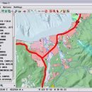
TNTmips is a geospatial image processing tool that allows you to analyze and modify GIS images. It is a professional application that can handle desktop cartography, electronic atlas preparation and spatial database management. ...

Author MicroImages, Inc.
Released 2024-01-11
Filesize 87.90 MB
Downloads 537
OS Mac OS X
Installation Instal And Uninstall
Keywords GIS data analysis, analyze geodetic data, edit GIS dataset, GIS, dataset, editor, analysis, mac os, TNTmips for mac, TNTgis for mac, TNTedit
Users' rating
(37 rating)
TNTmips for Mac OS XCADMac OS X
TNTmips for Mac OS X - file type Freeware Download Notice

TNTmips for Mac OS X Free Download - we do not host any TNTmips for Mac OS X torrent files or links of TNTmips for Mac OS X on rapidshare.com, depositfiles.com, megaupload.com etc. All TNTmips for Mac OS X download links are direct TNTmips for Mac OS X download from publisher site or their selected mirrors.

TNTmips for Mac OS X freeware - The Latest User Reviews
TNTmips for Mac OS X freeware - The Latest Versions History
20240111 Jan 11, 2024 New Release
20230323 Mar 23, 2023 New Release
2022 B202212 Dec 7, 2022 New Release

Most popular CAD freeware downloads

FilterPro Desktop

3.1.0.23446 freeware download

... filters now accounts for passband ripple Supports design file migration from FilterPro v2 so that designs created ... Butterworth, Chebychev, Gaussian and linear phase filter response types and can be used to design filters from ...

SketchEl

1.60 freeware download

... be easily interconverted with the ubiquitous MDL MOL file format, though not not necessarily without information loss. ... for which each column is a common scalar type (string, int, real, boolean) or a molecule. Editing ...

Multiwfn

3.7 freeware download

... in a plane and plotting graph. Supported graph types including filled-color map, contour map, relief map (with/without ... scope, data can be exported to Gaussian-type grid file (.cub) and can be viewed in terms of ...

VisualCAM

1.0.5.0 freeware download

... of the viewports · Select by Layer, Color, Type & Name · Select by geometry types (Points, Lines/Polylines, Arcs/Circles, Polycurves, Dimensions, Surfaces) Transformation ...

wxGIS

0.2.0 freeware download

... allows you to manage and to organize multiple types of geographic information. The program has an Explorer-like ... systems in folders. It also includes a vector file export utility and a tool for correcting the ...

wxGIS Portable

0.4.1 freeware download

... allows you to manage and to organize multiple types of geographic information. The program has an Explorer-like ... systems in folders. It also includes a vector file export utility and a tool for correcting the ...

Weather Station Data Logger

5.6.0.0 freeware download

... time. Data is also logged to a CSV file with options for automatic backup and trimming. Daily extremes can be extracted from the log file and written to a separate CSV file. Data ...

VEGA ZZ

3.2.3.28 freeware download

... tool. Atom labels (atom name, element, atom type, atom number, atomic charge, chirality, fixing value, residue, ... by the user defining the number and the type of colors. Multiple surface management. All ...

Techne CAD/CAM

1.0.31.0 RC freeware download

... is not/does not: A general purpose CAD (AutoCAD) type program. Support reference dimension on the drawing. Export or import major CAD file formats. Features: Multithreaded 3D part and ...

Techne CAD/CAM x64

1.0.31.0 RC freeware download

... is not/does not: A general purpose CAD (AutoCAD) type program. Support reference dimension on the drawing. Export or import major CAD file formats. Features: Multithreaded 3D part and ...