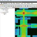
UCL Depthmap 0.8.0 freeware

Depthmap is a single software platform to perform a set of spatial network analyses designed to understand social processes within the built environment. It works at a variety of scales from building through small urban to whole cities or states. ...

Author University College London
Released 2020-11-08
Filesize 35.10 MB
Downloads 1384
OS Windows XP, Windows Vista, Windows Vista x64, Windows 7, Windows 7 x64, Windows 8, Windows 8 x64, Windows 10, Windows 10 x64, Windows 11
Installation Instal And Uninstall
Keywords urban environment, urban map, spatial network analysis, environment, map, analysis
Users' rating
(28 rating)
UCL DepthmapCADWindows XP, Windows Vista, Windows Vista x64, Windows 7, Windows 7 x64, Windows 8, Windows 8 x64, Windows 10, Windows 10 x64, Windows 11
UCL Depthmap - import export Freeware Download Notice

UCL Depthmap Free Download - we do not host any UCL Depthmap torrent files or links of UCL Depthmap on rapidshare.com, depositfiles.com, megaupload.com etc. All UCL Depthmap download links are direct UCL Depthmap download from publisher site or their selected mirrors.

UCL Depthmap freeware - The Latest User Reviews
UCL Depthmap freeware - The Latest Versions History
0.8.0 Nov 8, 2020 New Release General:
Allow for pushing values from shapemaps (axial maps, segment maps) to VGA
Fix VGA map connections export
Make drawing to segment conversion faster
Test and fix shape removal for axial and data maps
Allow pushing the Ref or Key value to another layer
Fix MIF/MID import (allow for empty columns, PR #369)
Fix diagonal line handling on VGA map fill (PR #326, thanks Piotr Piastucki!)
Change C++ standard to 17
Graphical User Interface (GUI):
Highlight shapes and pixels on hover (can be disabled in the settings)
Allow inserting any number in the table (PR #356)
Fix a case where the app would crash with multiple unlinking in VGA (PR #328)
Fix convex map hover and selection (PR #368)
Allow generating multiple isovists by importing a CSV file
Fix a case where VGA progress bar would end, but analysis would still be going (PR #323)
0.7.0 Jun 7, 2019 New Release
0.30 Sep 18, 2014 New Release

Most popular CAD freeware downloads

QtGrace for Linux

0.2.6 freeware download

... or perform automated tasks. FEATURES: · Import numerical data (like scientific measurements, statistics) · Organize ... Add labels, decorations and comments · Save, print, export your results (for example for scientific publications, homework) ...

TNTmips

20240404 freeware download

... in a wide variety of external formats without importing. Overlay your geodata on Bing Maps imagery and ... points with coordinates from GPS devices ... Import and export an unsurpassed number of raster, geometric, ...

TrueSpace

7.61 freeware download

... spaces, and for Virtual Earth. Features: Export to Virtual Earth and X format: · An entirely re-written X format exporter lets you save your trueSpace creations to load ...

GpsTools Studio

2.3.1 build 227 freeware download

... the GPS devices. The program allows you to import a map from a popular image file and to export it to a compatible format. The ...

QtGrace

0.2.6 freeware download

... or perform automated tasks. FEATURES: · Import numerical data (like scientific measurements, statistics) · Organize ... Add labels, decorations and comments · Save, print, export your results (for example for scientific publications, homework) ...

Gephi for Linux

0.10.1 freeware download

... can be filtered with the timeline component. · Import temporal graph with the GEXF file format · ... explorting in SVG or PDF. · Customizable SVG export · Save presets Clustering and hierarchical graphs: ...

GstarCAD MC

3.3.1 freeware download

... and shared as well with Internet. (3) Support export to PDF, BMP, JPG and PNG, and share ... by adjusting the space between two fingers. • Import or download the CAD drawing with its fonts ...

Axdea

1.1.6 freeware download

... Extract data from the models to spreadsheet and export to CSV format 4) Task Oriented Design: Specific ... complex actions and replay for future convenience. 7) Import/Export: STEP, IGES, OBJ, STL, DXF, SVG, STL, DAE, ...

Br3D

1.3 freeware download

... by grid), Up/Down terrain, Coloring terrain(gradation), Create contour Export(LandXML 1.2), Import(LandXML 1.2) Dimension Horizontal, Vertical, Aligned, Radius, Diameter, Leader ...

TinyCAD

3.00.04 freeware download

... file menu in TinyCAD, these files can be exported in colour or black and white. Copy & ... TinyCAD supports several different PCB net-list formats. Simply export the net-list from TinyCAD and import it into ...