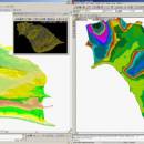
LanDTM 6.1 freeware

There is not any professional program on internet like this and you can get it without any effort. I think this could be a handicap because it's dificult to believe, but it's true; try it and you'll be surprised. It's not only a program to calculate a delaunay triangulation but you can input break-lines to get a real representation of the terrain. ...

Author Aplicaciones Topográficas S.L.
Released 2017-04-23
Filesize 58.80 MB
Downloads 639
OS Windows XP, Windows Vista, Windows Vista x64, Windows 7, Windows 7 x64, Windows 8, Windows 8 x64, Windows 10, Windows 10 x64
Installation Instal And Uninstall
Keywords Delaunay triangulation, Terrain Representation, CAD addon, Delaunay triangulation, Calculate, Terrain
Users' rating
(14 rating)
LanDTMCADWindows XP, Windows Vista, Windows Vista x64, Windows 7, Windows 7 x64, Windows 8, Windows 8 x64, Windows 10, Windows 10 x64
LanDTM - professional Freeware Download Notice

LanDTM Free Download - we do not host any LanDTM torrent files or links of LanDTM on rapidshare.com, depositfiles.com, megaupload.com etc. All LanDTM download links are direct LanDTM download from publisher site or their selected mirrors.

LanDTM freeware - The Latest User Reviews
LanDTM freeware - The Latest Versions History
6.1 Apr 23, 2017 New Release
6.1.6 Feb 16, 2012 New Release · New installers of the program to 32 and 64 bits platforms.
· LanDTM on BricsCAD v12.
· LanDTM on Autocad 2012.
· Separator/discriminator of points.
· Compatibility with "gsf" grid files REDNAP of Geoid ondulation.
· Elevation modification of PPuntos.
· Importation/exportationn of Points to PPuntos.
· Compatibility between formats. Trimble M3, GPS Trimble, GSI of Stonex.
6.1.5 Oct 5, 2011 New Release · You can digitalize lines and points in Google Earth and export them to the CAD. It Works in BricsCAD v11.

Most popular CAD freeware downloads

FilterPro Desktop

3.1.0.23446 freeware download

... schematics, view frequency and time responses, and print professional design reports containing all design data and schematics to help speed time to market. Supports Bessell, ...

3D Home Design by Livecad

3.1 freeware download

... regulatory standards, whilst benefitting from a range of professional tools to design, display, present and realise all ... 3D Home Design by LiveCAD® : a true professional solution for all types of buildings! - 2D ...

GiTools

2.2.2 freeware download

Gitools, is a framework for analysis and visualization of genomic data. Data and results are represented as browsable heatmaps. Gitools allows to import data directly from ...

M4 PERSONAL

7.0 freeware download

The free M4 PERSONAL CAD software is part of the M4 family of CAD solutions. Its extensive design functionality, similar to the most advanced commercial package, ...

CADEMIA for Mac

3.0 RC3 freeware download

Existing software tools for the planning process have severe limitations: They are restricted in openness, they are dependent on the platform, they are complex to use ...

QGIS for Mac

3.36.1 freeware download

QGIS is a professional GIS application that is built on top of and proud to be itself Free and Open Source Software (FOSS). QGIS ...

QGIS for Linux

3.36.1 freeware download

QGIS is a professional GIS application that is built on top of and proud to be itself Free and Open Source Software (FOSS). QGIS ...

SolidFace 3D CAD PTV

24.0.0.X freeware download

Professional 3D Modeling Software (CAD) PTV - A CAD rebuilt with everything you need, without the hassles you dont. True top-down design with configurations, standard ...

TNTmips for Mac OS X

20240111 freeware download

... publish any type of geospatial data. TNTmips provides professional geospatial tools in a single package at an affordable price without costly add-ons. Precisely overlay ...

LanDTM

6.1 freeware download

... presented in Spanish. There is not any professional program on internet like this and you can ... in 1992 and there are more of 3000 professionals working with it, civil engineers, architects, foreman builders, ...