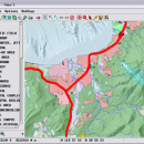
TNTmips 20240404 freeware

TNTmips is a geospatial image processing tool that allows you to analyze and modify GIS images. It is a professional application that can handle desktop cartography, electronic atlas preparation and spatial database management. ...

Author MicroImages, Inc.
Released 2024-04-04
Filesize 121.00 MB
Downloads 1667
OS Windows XP, Windows Vista, Windows Vista x64, Windows 7, Windows 7 x64, Windows 8, Windows 8 x64, Windows 10, Windows 10 x64, Windows 11
Installation Instal And Uninstall
Keywords GIS data analysis, analyze geodetic data, edit GIS dataset, GIS, dataset, editor, analysis
Users' rating
(118 rating)
TNTmipsCADWindows XP, Windows Vista, Windows Vista x64, Windows 7, Windows 7 x64, Windows 8, Windows 8 x64, Windows 10, Windows 10 x64, Windows 11
TNTmips - single number Freeware Download Notice

TNTmips Free Download - we do not host any TNTmips torrent files or links of TNTmips on rapidshare.com, depositfiles.com, megaupload.com etc. All TNTmips download links are direct TNTmips download from publisher site or their selected mirrors.

TNTmips freeware - The Latest User Reviews
TNTmips freeware - The Latest Versions History
20240404 Apr 4, 2024 New Release
20240131 Jan 31, 2024 New Release
20240108 Jan 8, 2024 New Release

Most popular CAD freeware downloads

QGIS for Mac

3.36.1 freeware download

... daily GIS data viewing needs. QGIS supports a number of raster and vector data formats, with new support easily added using the plugin architecture. ...

QGIS for Linux

3.36.1 freeware download

... daily GIS data viewing needs. QGIS supports a number of raster and vector data formats, with new support easily added using the plugin architecture. ...

TNTmips

20240404 freeware download

... data. TNTmips provides professional geospatial tools in a single package at an affordable price without costly add-ons. ... devices ... Import and export an unsurpassed number of raster, geometric, and database file formats; convert ...

QGIS

3.36.1 freeware download

... daily GIS data viewing needs. QGIS supports a number of raster and vector data formats, with new support easily added using the plugin architecture. ...

OpalCalc

1.94 freeware download

... a tiny footprint on the screen for a single sum? Resize accordingly. Want it to fill the ... functions · Programmer syntax and functions · Custom number base support · Advanced notation support ...

Open3DALIGN x64

2.28 freeware download

... for each compound of the dataset either the single conformation originally imported or the conformational databases previously ... The QMD search is accomplished running a number of short molecular dynamics runs (using the MMFF94 ...

Thuban for Mac OS X

1.0.1-3 freeware download

... legend: The layers objects can be grouped by single values or ranges. Visibility and symbols can be ... uniform distribution and * quantiles. The number of groups is flexible, a ramp of symbols ...

p3d

2.6.2 freeware download

... combine several images (exposures) into one image, clean single images of cosmic-ray hits, can extract spectra using ... hits – two different algorithms are implemented for single images, as well as median stacking of three ...

Open3DALIGN

2.28 freeware download

... for each compound of the dataset either the single conformation originally imported or the conformational databases previously ... The QMD search is accomplished running a number of short molecular dynamics runs (using the MMFF94 ...

OpalCalc Portable

1.94 freeware download

... a tiny footprint on the screen for a single sum? Resize accordingly. Want it to fill the ... functions · Programmer syntax and functions · Custom number base support · Advanced notation support ...