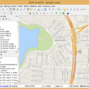
QGIS 3.36.1 freeware

QGIS supports vector, raster, and database formats and lets you browse and create map data on your computer.
QGIS supports many common spatial data formats (e.g. ESRI ShapeFile, geotiff). QGIS supports plugins to do things like display tracks from your GPS.
QGIS aims to be an easy to use GIS, providing common functions and features. The initial goal was to provide a GIS data viewer. ...

Author Gary Sherman
Released 2024-03-26
Filesize 1000.00 MB
Downloads 843
OS Windows XP, Windows Vista, Windows Vista x64, Windows 7, Windows 7 x64, Windows 8, Windows 8 x64, Windows 10, Windows 10 x64, Windows 11
Installation Instal And Uninstall
Keywords geographic information system, map creator, map viewer, GIS, geographic information, create, QGIS
Users' rating
(38 rating)
QGISCADWindows XP, Windows Vista, Windows Vista x64, Windows 7, Windows 7 x64, Windows 8, Windows 8 x64, Windows 10, Windows 10 x64, Windows 11
QGIS - source file Freeware Download Notice

QGIS Free Download - we do not host any QGIS torrent files or links of QGIS on rapidshare.com, depositfiles.com, megaupload.com etc. All QGIS download links are direct QGIS download from publisher site or their selected mirrors.

QGIS freeware - The Latest User Reviews
QGIS freeware - The Latest Versions History
3.36.1 Mar 26, 2024 New Release
3.36.2 Apr 25, 2024 New Release
3.36.1 Mar 26, 2024 New Release

Most popular CAD freeware downloads

TinyCAD

3.00.04 freeware download

... it for free and you can download the source code for use in your own projects. ... bitmap. TinyCAD supports outputing ciruits diagrams as PNG files. If you are not familar with PNG files, ...

Gephi

0.10.1 freeware download

... component. · Import temporal graph with the GEXF file format · Graph streaming ready Create cartography: ... in workspaces and save their session .gephi project files. · Save/Load project files · Use the Data ...

OpenRocket

14.06 freeware download

... and see screenshots. OpenRocket is an Open Source project licensed under the GNU GPL. This means ... free to use for whatever purposes, and the source code is also available for studying and extending. ...

PyNcView

0.99.8 Beta freeware download

View your NetCDF files with this tool. PyNcView is a cross-platform NetCDF viewer written in Python. It provides an easy to use graphical user interface ...

Mobile Atlas Creator for Mac OS X

2.2.1 freeware download

... known as TrekBuddy Atlas Creator) is an open source (GPL) program which creates offline atlases for GPS ... as one large PNG image with calibration MAP file for OziExplorer. As source for an offline atlas ...

Gnuplot for Windows

5.2.7 freeware download

... Windows, OSX, VMS, and many other platforms. The source code is copyrighted but freely distributed (i.e., you ... display: system-specific (OSX(aqua), svga, ...) direct output to file: postscript (including eps), pdf, png, gif, jpeg, LaTeX, ...

FreeMedForms

1.0.0 freeware download

FreeMedForms is free and open source software, available for all current platforms (Linux, Mac ... specialties and even veterinary profession. The patient file is fully editable. It is built with an ...

Multiwfn

3.7 freeware download

... scope, data can be exported to Gaussian-type grid file (.cub) and can be viewed in terms of ... dimension, the operations between data generated from multiple files can be defined. · Promolecule and deformation properties ...

FreeMedForms Portable

1.0.0 freeware download

FreeMedForms is free and open source software, available for all current platforms (Linux, Mac ... specialties and even veterinary profession. The patient file is fully editable. It is built with an ...

wxGIS

0.2.0 freeware download

... systems in folders. It also includes a vector file export utility and a tool for correcting the orthographic data from raster TIFF files. ...