TNTmips 20240404 freeware

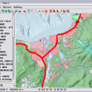
... can handle desktop cartography, electronic atlas preparation and spatial database management. ...

Author MicroImages, Inc.
Released 2024-04-04
Filesize 121.00 MB
Downloads 1645
OS Windows XP, Windows Vista, Windows Vista x64, Windows 7, Windows 7 x64, Windows 8, Windows 8 x64, Windows 10, Windows 10 x64, Windows 11
Installation Instal And Uninstall
Keywords GIS data analysis, analyze geodetic data, edit GIS dataset, GIS, dataset, editor, analysis
Users' rating
(116 rating)
TNTmipsCADWindows XP, Windows Vista, Windows Vista x64, Windows 7, Windows 7 x64, Windows 8, Windows 8 x64, Windows 10, Windows 10 x64, Windows 11
TNTmips - spatial Freeware Download Notice

TNTmips Free Download - we do not host any TNTmips torrent files or links of TNTmips on rapidshare.com, depositfiles.com, megaupload.com etc. All TNTmips download links are direct TNTmips download from publisher site or their selected mirrors.

TNTmips freeware - The Latest User Reviews
TNTmips freeware - The Latest Versions History
20240404 Apr 4, 2024 New Release
20240131 Jan 31, 2024 New Release
20240108 Jan 8, 2024 New Release

Most popular CAD freeware downloads

QGIS for Mac

3.36.1 freeware download

... on your computer. QGIS supports many common spatial data formats (e.g. ESRI ShapeFile, geotiff). QGIS supports ... key features of "QGIS": · Support for spatially enabled PostgreSQL tables using PostGIS · Support for ...

QGIS for Linux

3.36.1 freeware download

... on your computer. QGIS supports many common spatial data formats (e.g. ESRI ShapeFile, geotiff). QGIS supports ... key features of "QGIS": · Support for spatially enabled PostgreSQL tables using PostGIS · Support for ...

Multiwfn

3.7 freeware download

... vector field map. · Outputting properties in a spatial scope, data can be exported to Gaussian-type grid ... Plotting scatter map for two functions in specific spatial scope, integrating a real space function in whole ...

CARIS Easy View

4.2.13 freeware download

... a simple application that enables you to view spatial data imported from numerous types of files. It ... their order and adjust object parameters. View your spatial data using the free CARIS viewer. CARIS Easy ...

PAST for Mac OS X

4.03 freeware download

... and multivariate statistics, ecological analysis, time series and spatial analysis, morphometrics and stratigraphy. Past comes with a straightforward approach when it comes to data ...

QGIS

3.36.1 freeware download

... on your computer. QGIS supports many common spatial data formats (e.g. ESRI ShapeFile, geotiff). QGIS supports ... key features of "QGIS": · Support for spatially enabled PostgreSQL tables using PostGIS · Support for ...

TNTmips for Mac OS X

20240111 freeware download

... JPEG2000, PNG, MrSID, ECW, shapefile, File Geodatabase, Oracle Spatial, DGN, TAB, DXF, DWG. Full-featured GIS that integrates imagery along with geometric data including vector, ...

UCL Depthmap

0.8.0 freeware download

... single software platform to perform a set of spatial network analyses designed to understand social processes within the built environment. It works at a variety ...

p3d

2.6.2 freeware download

... implemented for 5 instrument setups that use square-shaped spatial elements: PMAS/Larr, Spiral, VIMOS, FLAMES/Argus, and MPFS). Convert ... implemented for 6 instrument setups that use square-shaped spatial elements: PMAS/Larr, Spiral, VIMOS, FLAMES, MPFS, and ERA2) ...

ANTz

2019-03-18 freeware download

... it as 'spreadsheet meets cyberspace.' An immersive multi-dimensional spatially based environment for realtime analysis and decision making. ... such as geometry, transparency, velocity and position. Spatial cues based on shape, color, size and texture ...