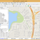
QGIS for Mac 3.36.2 freeware

New Version

QGIS supports vector, raster, and database formats and lets you browse and create map data on your computer.
QGIS supports many common spatial data formats (e.g. ESRI ShapeFile, geotiff). QGIS supports plugins to do things like display tracks from your GPS.
QGIS aims to be an easy to use GIS, providing common functions and features. The initial goal was to provide a GIS data viewer. ...

Author Gary Sherman
Released 2024-04-25
Filesize 1600.00 MB
Downloads 698
OS Mac OS X
Installation Instal And Uninstall
Keywords geographic information system, map creator, map viewer, GIS, geographic information, create, QGIS for Mac
Users' rating
(22 rating)
QGIS for MacCADMac OS X
QGIS for Mac - system tool Freeware Download Notice

QGIS for Mac Free Download - we do not host any QGIS for Mac torrent files or links of QGIS for Mac on rapidshare.com, depositfiles.com, megaupload.com etc. All QGIS for Mac download links are direct QGIS for Mac download from publisher site or their selected mirrors.

QGIS for Mac freeware - The Latest User Reviews
QGIS for Mac freeware - The Latest Versions History
3.36.2 Apr 25, 2024 New Release
3.36.1 Mar 26, 2024 New Release
3.34.4 Feb 28, 2024 New Release

Most popular CAD freeware downloads

TNTmips for Mac OS X

20240111 freeware download

TNTmips for Mac is a complete Geographic Information System (GIS) that lets you work with virtually any ... with associated database attributes. It provides all the tools you need to view, create, edit, georeference, interpret, ...

FilterPro Desktop

3.1.0.23446 freeware download

... to Excel. FilterPro active filter design tool allows designers to create and edit active filter ... all-pass phase shift/time delay filters to help ease system design. ...

ProfiCAD

12.4.4 freeware download

... to learn and use, it is a professional tool used by a wide range of customers. ... just drag symbols onto the drawing low system requirements - runs on any PC with Windows ...

QGIS for Mac

3.36.2 freeware download

... Improved vector and attribute editing · Improved measure tools with area measuring · Attribute searching · New ... libraries in mapping applications · Improved MapServer export tool · Vector layer transparency and antialiasing · GRASS ...

New Version

QGIS for Linux

3.36.2 freeware download

... Improved vector and attribute editing · Improved measure tools with area measuring · Attribute searching · New ... libraries in mapping applications · Improved MapServer export tool · Vector layer transparency and antialiasing · GRASS ...

New Version

QGIS

3.36.2 freeware download

... Improved vector and attribute editing · Improved measure tools with area measuring · Attribute searching · New ... libraries in mapping applications · Improved MapServer export tool · Vector layer transparency and antialiasing · GRASS ...

New Version

TNTmips

20240404 freeware download

TNTmips software is a complete Geographic Information System (GIS) that lets you work with virtually any ... with associated database attributes. It provides all the tools you need to view, create, edit, georeference, interpret, ...

Euler Math Toolbox

2024-01-14 freeware download

The Euler Mathematical Toolbox is a software written and maintained by R. ... with Euler through pipes. It remains a separated system. However, there are various interactions between Euler and ...

Harmonic Manipulator

0.9.6.1 freeware download

... grids (provided in a geodetic or geocentric reference system). It exploits basic parallelism using openmp directives. A solution with MPI has not be taken ...

DipTrace Free

4.3.0.0 freeware download

... Schematic Capture, Component and Pattern Editors. This EDA tool is a perfect combination of wide engineering capabilities ... Layout features a shape-based autorouter, high-speed/differential signal routing tools and 3D PCB Preview/Export. Schematic Capture works with ...