Portable Kalkules 1.11.0.28 freeware

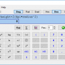
Kalkules is an universal scientific freeware calculator with an amount of untraditional functions, which can be used particularly by high school or university students. It also offers a wide range of tools, which make your calculations easier and faster. ...

Author Jardo
Released 2019-11-20
Filesize 1.30 MB
Downloads 1187
OS Windows XP, Windows Vista, Windows Vista x64, Windows 7, Windows 7 x64, Windows 8, Windows 8 x64, Windows 10, Windows 10 x64
Installation Instal And Uninstall
Keywords scientific calculator, solve math equation, calculate fraction, solve, calculator, calculate
Users' rating
(20 rating)
Portable KalkulesCADWindows XP, Windows Vista, Windows Vista x64, Windows 7, Windows 7 x64, Windows 8, Windows 8 x64, Windows 10, Windows 10 x64
Our rating 5 freeware award
Portable Kalkules - 10 8 3 Freeware Download Notice

Portable Kalkules Free Download - we do not host any Portable Kalkules torrent files or links of Portable Kalkules on rapidshare.com, depositfiles.com, megaupload.com etc. All Portable Kalkules download links are direct Portable Kalkules download from publisher site or their selected mirrors.

Portable Kalkules freeware - The Latest User Reviews
Portable Kalkules freeware - The Latest Versions History
1.11.0.28 Nov 20, 2019 New Release Improvements:
Added offline differentiation algorithm as fallback in case the online server is down.
Changed font colors on main window buttons for better contrast and readability.
1.11.0.27 Nov 13, 2018 New Release Improvements:
Added offline differentiation algorithm as fallback in case the online server is down.
Changed font colors on main window buttons for better contrast and readability.
1.10.0.26 Oct 25, 2018 New Release Added Turkish translation
Added function exp(x) (equivalent to expression $e^x)

Most popular CAD freeware downloads

SCaVis

2.3 freeware download

SCaVis is an environment for scientific computation, data analysis and data visualization designed for scientists, engineers and students. The program incorporates many open-source software packages into ...

5 freeware award

Antenna Design Calculator

2.3 freeware download

The antenna calculator is a very simple and easy piece of software. This calculator provides quick estimation of antenna size required for a given gain and ...

FreeDiams for Mac OS X

1.0.0 freeware download

FreeDiams prescriber is the result of FreeMedForms prescriber plugins built into a standalone application. FreeDiams is a multi-platform (MacOS, Linux, FreeBSD, Windows), free and open source ...

DX Central for Linux

2.20 freeware download

DX_Central is a desktop application for those interested in observing the earth's sun or it's effect on radio propagation. This small application provides images of the ...

PAST for Mac OS X

4.03 freeware download

Past is free software for scientific data analysis, with functions for data manipulation, plotting, univariate and multivariate statistics, ecological analysis, time series and spatial analysis, morphometrics ...

EnCalc

4.2 freeware download

EnCalc (Calc4all) is a portable windows calculator with practical built in features! This project started out because there was no other simple portable calculator out there ...

nanoCAD

5.1.2524.2017 freeware download

nanoCAD - easy-to-use free CAD software delivering great user experience by providing classic interface and native .dwg support. Being the ultimate in 2D design tools, nanoCAD ...

PAST

4.03 freeware download

Past is free software for scientific data analysis, with functions for data manipulation, plotting, univariate and multivariate statistics, ecological analysis, time series and spatial analysis, morphometrics ...

Webots PRO for Linux

R2023a freeware download

Webots is a development environment used to model, program and simulate mobile robots. With Webots the user can design complex robotic setups, with one or several, ...

TNTmips for Mac OS X

20240111 freeware download

TNTmips for Mac is a complete Geographic Information System (GIS) that lets you work with virtually any type of geospatial data including imagery, terrain surfaces, and ...