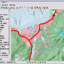
TNTmips 20240404 freeware

... that allows you to analyze and modify GIS images. It is a professional application that can handle desktop cartography, electronic atlas preparation and spatial database management. ...

Author MicroImages, Inc.
Released 2024-04-04
Filesize 121.00 MB
Downloads 1646
OS Windows XP, Windows Vista, Windows Vista x64, Windows 7, Windows 7 x64, Windows 8, Windows 8 x64, Windows 10, Windows 10 x64, Windows 11
Installation Instal And Uninstall
Keywords GIS data analysis, analyze geodetic data, edit GIS dataset, GIS, dataset, editor, analysis
Users' rating
(118 rating)
TNTmipsCADWindows XP, Windows Vista, Windows Vista x64, Windows 7, Windows 7 x64, Windows 8, Windows 8 x64, Windows 10, Windows 10 x64, Windows 11
TNTmips - 3d images Freeware Download Notice

TNTmips Free Download - we do not host any TNTmips torrent files or links of TNTmips on rapidshare.com, depositfiles.com, megaupload.com etc. All TNTmips download links are direct TNTmips download from publisher site or their selected mirrors.

TNTmips freeware - The Latest User Reviews
TNTmips freeware - The Latest Versions History
20240404 Apr 4, 2024 New Release
20240131 Jan 31, 2024 New Release
20240108 Jan 8, 2024 New Release

Most popular CAD freeware downloads

PotterDraw

1.0.02.000 freeware download

... both texture mapping and vertex color. Export 2D images as BMP or PNG files. Built-in palette editor; print and print preview; full screen mode. Tabbed ...

3D Architecture by LiveCAD

2.1 freeware download

... straight and corner bathtubs, accessories etc. - Calculate images using ray tracing - Global Illumination for a hyper-realistic photo quality rendering - Control the type ...

ShareCAD

2.0 freeware download

... installing any additional software; - zoom and rotate images, change display modes and use measuring tools; - print drawings; - create temporary links that will ...

MOPlot

1.93 freeware download

... mode. Pages can be configured to hold multiple images of any kind that can be displayed on the screen. MOPlot output can thus be imported ...

Gwyddion

2.66 freeware download

... axes scale callibration · merging and immersion of images · tip modelling, blind estimation, dilation and erosion ...

NetLogo

6.0.4 freeware download

... for annotating your model with formatted text and images HubNet: participatory simulations using networked devices Agent monitors for inspecting and controlling agents Export and import ...

Elshayal Smart

23.02 freeware download

... save GPS route and View and Rectify Raster Images gif, jpg, bmp and Edit shape files, build new layer, add existing layer, remove layers, swap ...

TNTmips for Mac OS X

20240111 freeware download

TNTmips for Mac is a complete Geographic Information System (GIS) that lets you work with virtually any type of geospatial data including imagery, terrain surfaces, and ...

TrueSpace

7.61 freeware download

... and render 3D content. As well as traditional images and movies, you can also make 3D content for online shared spaces, and for Virtual Earth. ...

3D Home Design by Livecad

3.1 freeware download

... straight and corner bathtubs, accessories etc. - Calculate images using ray tracing - Global Illumination for a hyper-realistic photo quality rendering - Control the type ...