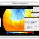
Panoply for Mac 5.3.4 freeware

Panoply for Mac is an utility that enable user to plot raster image. Depending on the data, it can draw global longitude-latitude images or pole-to-pole latitude-vertical images.Panoply is a cross-platform application which plots geo-gridded arrays from netCDF, HDF and GRIB datasets. The utility can also combine two arrays and can project the analysis using more than 100 maps.

Author Robert B. Schmunk
Released 2024-03-29
Filesize 36.40 MB
Downloads 498
OS Mac OS X
Installation Instal And Uninstall
Keywords plot raster image, longitude image, pole-to-pole image, raster image, rasterize, raster
Users' rating
(24 rating)
Panoply for MacCADMac OS X
Panoply for Mac - Freeware Download Notice

Panoply for Mac Free Download - we do not host any Panoply for Mac torrent files or links of Panoply for Mac on rapidshare.com, depositfiles.com, megaupload.com etc. All Panoply for Mac download links are direct Panoply for Mac download from publisher site or their selected mirrors.

Panoply for Mac freeware - The Latest User Reviews
Panoply for Mac freeware - The Latest Versions History
5.3.4 Mar 29, 2024 New Release
5.3.3 Mar 1, 2024 New Release
5.3.2 Jan 31, 2024 New Release

Most popular CAD freeware downloads

Panoply for Mac

5.3.4 freeware download

Quickly plot images for the latitude-longitude data contained by netCDF datasets

SearchGUI

4.3.8 freeware download

An efficient and flexible Java-based application

New Version

TNTmips for Mac OS X

20240111 freeware download

Analyze complex GIS data, process and modify map images

FilterPro Desktop

3.1.0.23446 freeware download

Designed to create filter models for your projects

QGIS for Mac

3.36.1 freeware download

Lets you browse and create map data on your computer

LTspice IV

24.0.11 freeware download

A software to help you simulate switching regulators

QGIS for Linux

3.36.1 freeware download

Lets you browse and create map data on your computer

ProfiCAD

12.4.4 freeware download

Software for electrical diagrams, schematics and other technical documents

TNTmips

20240404 freeware download

Analyze complex GIS data, process and modify map images

Panoply

5.3.4 freeware download

Lets you view photos created with NetCDF, HDF, GEMPACK, GRIB