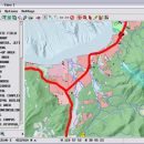
TNTmips for Mac OS X 20240111 freeware

TNTmips is a geospatial image processing tool that allows you to analyze and modify GIS images. It is a professional application that can handle desktop cartography, electronic atlas preparation and spatial database management. ...

Author MicroImages, Inc.
Released 2024-01-11
Filesize 87.90 MB
Downloads 573
OS Mac OS X
Installation Instal And Uninstall
Keywords GIS data analysis, analyze geodetic data, edit GIS dataset, GIS, dataset, editor, analysis, mac os, TNTmips for mac, TNTgis for mac, TNTedit
Users' rating
(42 rating)
TNTmips for Mac OS XCADMac OS X
TNTmips for Mac OS X - analysis software Freeware Download Notice

TNTmips for Mac OS X Free Download - we do not host any TNTmips for Mac OS X torrent files or links of TNTmips for Mac OS X on rapidshare.com, depositfiles.com, megaupload.com etc. All TNTmips for Mac OS X download links are direct TNTmips for Mac OS X download from publisher site or their selected mirrors.

TNTmips for Mac OS X freeware - The Latest User Reviews
TNTmips for Mac OS X freeware - The Latest Versions History
20240111 Jan 11, 2024 New Release
20230323 Mar 23, 2023 New Release
2022 B202212 Dec 7, 2022 New Release

Most popular CAD freeware downloads

QXRD

0.11.10.16 freeware download

QXRD is software for the acquisition and analysis of X-ray data taken with 2 dimensional detectors. The software can drive a Perkin Elmer XRD series flat ...

QGIS for Mac

3.36.1 freeware download

... proud to be itself Free and Open Source Software (FOSS). QGIS supports vector, raster, and database ... files · GRASS integration, including view, edit, and analysis · On the fly projection of vector layers ...

TNTmips

20240404 freeware download

TNTmips software is a complete Geographic Information System (GIS) that lets you work with virtually any type of geospatial data including imagery, terrain surfaces, and ...

GeoMapApp

3.7.1 freeware download

... display customization and analytical tools to support the analysis of multidisciplinary data sets. Choose from Mercator, North ... Several custom portals provide visualization and basic analysis for data types that typically require specialist software. ...

QGIS for Linux

3.36.1 freeware download

... proud to be itself Free and Open Source Software (FOSS). QGIS supports vector, raster, and database ... files · GRASS integration, including view, edit, and analysis · On the fly projection of vector layers ...

QFitsView

8.6 freeware download

... robust and versatile astronomical imaging and data visualization software that has become an indispensable tool for astronomers ... to handle the complex demands of astronomical data analysis, DS9 offers a comprehensive suite of features that ...

TNTmips for Mac OS X

20240111 freeware download

... and triangulated irregular networks (TINs), respectively. TNTgis software on macOS runs under the XQuartz X Window ... XQuartz 2.7.9 and install it before running TNTgis software. Note that TNTmips will run under XQuartz 2.7.10 ...

CARIS Easy View

4.2.13 freeware download

... of file types without the need for specialized software. CARIS Easy View gives users control of ... make selections and query 2D layers for additional analysis of the data. Using the 3D visualization engine, ...

QGIS

3.36.1 freeware download

... proud to be itself Free and Open Source Software (FOSS). QGIS supports vector, raster, and database ... files · GRASS integration, including view, edit, and analysis · On the fly projection of vector layers ...

Gwyddion for Linux

2.66 freeware download

... for SPM (scanning probe microscopy) data visualization and analysis. Primarily it is intended for analysis of height fields obtained by scanning probe microscopy ... used for any other height field and image analysis, for instance for analysis of profilometry data (learn ...