TNTmips 20240131 freeware

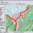
TNTmips is a geospatial image processing tool that allows you to analyze and modify GIS images. It is a professional application that can handle desktop cartography, electronic atlas preparation and spatial database management. ...

Author MicroImages, Inc.
Released 2024-01-31
Filesize 121.00 MB
Downloads 1563
OS Windows XP, Windows Vista, Windows Vista x64, Windows 7, Windows 7 x64, Windows 8, Windows 8 x64, Windows 10, Windows 10 x64, Windows 11
Installation Instal And Uninstall
Keywords GIS data analysis, analyze geodetic data, edit GIS dataset, GIS, dataset, editor, analysis
Users' rating
(91 rating)
TNTmipsCADWindows XP, Windows Vista, Windows Vista x64, Windows 7, Windows 7 x64, Windows 8, Windows 8 x64, Windows 10, Windows 10 x64, Windows 11
TNTmips - analysis software Freeware Download Notice

TNTmips Free Download - we do not host any TNTmips torrent files or links of TNTmips on rapidshare.com, depositfiles.com, megaupload.com etc. All TNTmips download links are direct TNTmips download from publisher site or their selected mirrors.

TNTmips freeware - The Latest User Reviews
TNTmips freeware - The Latest Versions History
20240131 Jan 31, 2024 New Release
20240108 Jan 8, 2024 New Release
20231103 Nov 3, 2023 New Release

Most popular CAD freeware downloads

Digimizer

6.4.0 freeware download

Digimizer is an easy-to-use and flexible image analysis software package that allows precise manual measurements as well ... mile (mi), degrees (°) or pixels Image analysis Binarization Options: overlay binary image, hide binary ...

New Version

TNTmips for Mac OS X

20240111 freeware download

... and triangulated irregular networks (TINs), respectively. TNTgis software on macOS runs under the XQuartz X Window ... XQuartz 2.7.9 and install it before running TNTgis software. Note that TNTmips will run under XQuartz 2.7.10 ...

QGIS for Mac

3.34.4 freeware download

... proud to be itself Free and Open Source Software (FOSS). QGIS supports vector, raster, and database ... files · GRASS integration, including view, edit, and analysis · On the fly projection of vector layers ...

Gwyddion

2.65 freeware download

... for SPM (scanning probe microscopy) data visualization and analysis. Primarily it is intended for analysis of height fields obtained by scanning probe microscopy ... used for any other height field and image analysis, for instance for analysis of profilometry data (learn ...

Gephi

0.10.1 freeware download

... now recognized to facilitate reasoning. This is a software for Exploratory Data Analysis, a paradigm appeared in the Visual Analytics field ... offer the most common metrics for social network analysis (SNA) and scale-free networks. · Betweenness, Closeness, Diameter, ...

Gephi for Mac OS X

0.10.1 freeware download

... now recognized to facilitate reasoning. This is a software for Exploratory Data Analysis, a paradigm appeared in the Visual Analytics field ... offer the most common metrics for social network analysis (SNA) and scale-free networks. · Betweenness, Closeness, Diameter, ...

Sonnet Lite

18.53 freeware download

... of Sonnet's professional Sonnet Suites, which provides EM analysis to thousands of companies across the globe. Many ... bridges Via (inter-layer or grounded) Coupled transmission line analysis Microwave circuit discontinuities Broadside-coupled transmission lines Planar interconnects ...

TNTmips

20240131 freeware download

TNTmips software is a complete Geographic Information System (GIS) that lets you work with virtually any type of geospatial data including imagery, terrain surfaces, and ...

QGIS

3.34.4 freeware download

... proud to be itself Free and Open Source Software (FOSS). QGIS supports vector, raster, and database ... files · GRASS integration, including view, edit, and analysis · On the fly projection of vector layers ...

QGIS for Linux

3.34.4 freeware download

... proud to be itself Free and Open Source Software (FOSS). QGIS supports vector, raster, and database ... files · GRASS integration, including view, edit, and analysis · On the fly projection of vector layers ...