TNTmips for Mac OS X 20240111 freeware

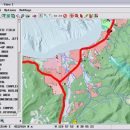
TNTmips is a geospatial image processing tool that allows you to analyze and modify GIS images. It is a professional application that can handle desktop cartography, electronic atlas preparation and spatial database management. ...

Author MicroImages, Inc.
Released 2024-01-11
Filesize 87.90 MB
Downloads 582
OS Mac OS X
Installation Instal And Uninstall
Keywords GIS data analysis, analyze geodetic data, edit GIS dataset, GIS, dataset, editor, analysis, mac os, TNTmips for mac, TNTgis for mac, TNTedit
Users' rating
(42 rating)
TNTmips for Mac OS XCADMac OS X
TNTmips for Mac OS X - analysis tools Freeware Download Notice

TNTmips for Mac OS X Free Download - we do not host any TNTmips for Mac OS X torrent files or links of TNTmips for Mac OS X on rapidshare.com, depositfiles.com, megaupload.com etc. All TNTmips for Mac OS X download links are direct TNTmips for Mac OS X download from publisher site or their selected mirrors.

TNTmips for Mac OS X freeware - The Latest User Reviews
TNTmips for Mac OS X freeware - The Latest Versions History
20240111 Jan 11, 2024 New Release
20230323 Mar 23, 2023 New Release
2022 B202212 Dec 7, 2022 New Release

Most popular CAD freeware downloads

PyMCA

5.5.5 freeware download

... most of the needs of X-ray fluorescence data analysis. For the developer, the PyMca Toolkit is a collection of Python tools for visualization and analysis of energy-dispersive X-ray fluorescence ...

QFitsView

8.6 freeware download

... to handle the complex demands of astronomical data analysis, DS9 offers a comprehensive suite of features that ... standout features is its extensive suite of visualization tools. Users can customize their viewing experience with a ...

QGIS for Linux

3.36.1 freeware download

... files · GRASS integration, including view, edit, and analysis · On the fly projection of vector layers ... Improved vector and attribute editing · Improved measure tools with area measuring · Attribute searching · New ...

Graph Streaming

0.7.0.12 freeware download

... standardized API could bring interoperability with other available tools for graph and network analysis, as they could start to interoperate with other tools in a distributed and cooperative fashion. With ...

TNTmips

20240404 freeware download

... with associated database attributes. It provides all the tools you need to view, create, edit, georeference, interpret, ... type of geospatial data. TNTmips provides professional geospatial tools in a single package at an affordable price ...

QGIS for Mac

3.36.1 freeware download

... files · GRASS integration, including view, edit, and analysis · On the fly projection of vector layers ... Improved vector and attribute editing · Improved measure tools with area measuring · Attribute searching · New ...

QGIS

3.36.1 freeware download

... files · GRASS integration, including view, edit, and analysis · On the fly projection of vector layers ... Improved vector and attribute editing · Improved measure tools with area measuring · Attribute searching · New ...

DWSIM

6.6.2 freeware download

... means of inputting user data through Utilities and Tools: Utilities: Phase Envelope, Hydrate Calculations, Pure Component Properties, ... Vessel Sizing, Spreadsheet and Petroleum Cold Flow Properties Tools: Hypothetical Component Generator, Bulk C7+/Distillation Curves Petroleum Characterization, ...

JMARS

3.1.5 freeware download

... an acronym that stands for Java Mission-planning and Analysis for Remote Sensing. It is a geospatial information ... Flight Facility to provide mission planning and data-analysis tools to NASA's orbiters, instrument team members, students of ...

5 freeware award

Thuban for Windows

1.2.2 freeware download

... Software GIS projects. Many valuable and highly sophisticated tools exist, but there is still a need for ... Automatic Classification Thuban supports explorative data analysis with automatic classifications of data. Supported are: ...