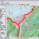
TNTmips 20240404 freeware

TNTmips is a geospatial image processing tool that allows you to analyze and modify GIS images. It is a professional application that can handle desktop cartography, electronic atlas preparation and spatial database management. ...

Author MicroImages, Inc.
Released 2024-04-04
Filesize 121.00 MB
Downloads 1645
OS Windows XP, Windows Vista, Windows Vista x64, Windows 7, Windows 7 x64, Windows 8, Windows 8 x64, Windows 10, Windows 10 x64, Windows 11
Installation Instal And Uninstall
Keywords GIS data analysis, analyze geodetic data, edit GIS dataset, GIS, dataset, editor, analysis
Users' rating
(116 rating)
TNTmipsCADWindows XP, Windows Vista, Windows Vista x64, Windows 7, Windows 7 x64, Windows 8, Windows 8 x64, Windows 10, Windows 10 x64, Windows 11
TNTmips - analyze image Freeware Download Notice

TNTmips Free Download - we do not host any TNTmips torrent files or links of TNTmips on rapidshare.com, depositfiles.com, megaupload.com etc. All TNTmips download links are direct TNTmips download from publisher site or their selected mirrors.

TNTmips freeware - The Latest User Reviews
TNTmips freeware - The Latest Versions History
20240404 Apr 4, 2024 New Release
20240131 Jan 31, 2024 New Release
20240108 Jan 8, 2024 New Release

Most popular CAD freeware downloads

GelAnalyzer

23.1.1 freeware download

... to help you with the 1D gel electrophoresis image analysis. The process of gel image analysis is straightforward and covers all the main ...

Digimizer

6.4.0 freeware download

Digimizer is an easy-to-use and flexible image analysis software package that allows precise manual measurements ... BMP, PNG, WMF, EMF and DICOM files. Images can be rotated, flipped or straightened. Image brightness ...

Gwyddion

2.66 freeware download

... generally used for any other height field and image analysis, for instance for analysis of profilometry data ... axes scale callibration · merging and immersion of images · tip modelling, blind estimation, dilation and erosion ...

DSI Studio

.59 freeware download

... (DSI) · Generalized Q-sampling Imaging (GQI) Supported image format: · DICOM (multi-slices/mosaic) · Analyze/NIFTI · bruker 2dseq Tractography: · Stream-line tracking ... Supported file format for input ROI: text file, Analyze, NIFTI · Supported file format for output tracts: ...

Energy2D

2.6 freeware download

... comparison of the results of Energy2D simulations with images from infrared (IR) thermography for a simple house. ... by Energy2D closely match those from an infrared imager. The second set of image shows a similarity ...

Energy2D for Mac OS X

2.6 freeware download

... comparison of the results of Energy2D simulations with images from infrared (IR) thermography for a simple house. ... by Energy2D closely match those from an infrared imager. The second set of image shows a similarity ...

SeiSee

2.22.6 freeware download

... the users that need to view and to analyze the data about earthquakes stored in SEG-Y files. ... variable area, variable density, color) - scaling seismic image, gain control, axes labeling setup - plots seismic ...

TNTmips for Mac OS X

20240111 freeware download

... with virtually any type of geospatial data including imagery, terrain surfaces, and map data with associated database ... without importing. Overlay your geodata on Bing Maps imagery and maps or on geodata layers published on ...

Melanie Viewer

7.0.7 freeware download

... from databases such as SWISS-2DPAGE, or any other image files with an appropriate format (.tif, .gel, etc.). ... and matches cannot be created or edited. Gel images cannot be edited (rotated, cropped, or flipped). The ...

TinyQuant

1.55 freeware download

A miniature utility for gel image analysis. Useful for integrating densities of gel bands ... or TIFF files) or 24 bit RGB TIFF images, and for converting these to 8 bit greyscale ...