Maps coloring 1.9 freeware

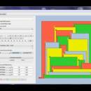
Maps coloring is a small, easy to use, Java based application specially designed to help you find a very simple pencil and paper proof of the four color problem. ...

Author Mario Stefanutti
Released 2013-01-28
Filesize 8.10 MB
Downloads 367
OS Windows XP, Windows Vista, Windows Vista x64, Windows 7, Windows 7 x64, Mac OS X
Installation Instal And Uninstall
Keywords analyze four color problem, solve four color problem, pencil and paper proof, analysis, analyze, solve
Users' rating
(14 rating)
Maps coloringCADWindows XP, Windows Vista, Windows Vista x64, Windows 7, Windows 7 x64, Mac OS X
Maps coloring - analyze Freeware Download Notice

Maps coloring Free Download - we do not host any Maps coloring torrent files or links of Maps coloring on rapidshare.com, depositfiles.com, megaupload.com etc. All Maps coloring download links are direct Maps coloring download from publisher site or their selected mirrors.

Maps coloring freeware - The Latest User Reviews
Maps coloring freeware - The Latest Versions History
1.9 Jan 28, 2013 New Release
1.8 Mar 28, 2012 New Release

Most popular CAD freeware downloads

EQAlign

2.3.7 freeware download

EQAlign born as a software that assists to align a German Equatorial Mount (GEM) exactly to the Earth polar axis. The used method is that of ...

QXRD

0.11.10.16 freeware download

QXRD is software for the acquisition and analysis of X-ray data taken with 2 dimensional detectors. The software can drive a Perkin Elmer XRD series flat ...

MicroDicom x64

2024.2 freeware download

MicroDicom x64 is application for primary processing and preservation of medical images in DICOM format. It is equipped with most common tools for manipulation of DICOM ...

TNTmips

20240404 freeware download

TNTmips software is a complete Geographic Information System (GIS) that lets you work with virtually any type of geospatial data including imagery, terrain surfaces, and map ...

Portable MicroDicom

2024.2 freeware download

MicroDicom is application for primary processing and preservation of medical images in DICOM format. It is equipped with most common tools for manipulation of DICOM images ...

QFitsView

8.6 freeware download

SAOImage DS9, developed by Eric Mandel, is a robust and versatile astronomical imaging and data visualization software that has become an indispensable tool for astronomers and ...

TNTmips for Mac OS X

20240111 freeware download

TNTmips for Mac is a complete Geographic Information System (GIS) that lets you work with virtually any type of geospatial data including imagery, terrain surfaces, and ...

MicroDicom

2024.2 freeware download

MicroDicom is application for primary processing and preservation of medical images in DICOM format. It is equipped with most common tools for manipulation of DICOM images ...

MITO

2.0 freeware download

The "MITO - Medical Imaging TOolkit" project coagulates a number of activities aimed at defining and implementing an open-source, cross-platform software architecture for advanced Medical Imaging. ...

CARIS Easy View

4.2.13 freeware download

... a wide range file types, enabling you to analyze raster and vector data saved to numerous formats. ... application that can be used to view and analyze spatial data. It is easy-to-use and includes extensive ...