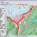
TNTmips 20240404 freeware

TNTmips is a geospatial image processing tool that allows you to analyze and modify GIS images. It is a professional application that can handle desktop cartography, electronic atlas preparation and spatial database management. ...

Author MicroImages, Inc.
Released 2024-04-04
Filesize 121.00 MB
Downloads 1574
OS Windows XP, Windows Vista, Windows Vista x64, Windows 7, Windows 7 x64, Windows 8, Windows 8 x64, Windows 10, Windows 10 x64, Windows 11
Installation Instal And Uninstall
Keywords GIS data analysis, analyze geodetic data, edit GIS dataset, GIS, dataset, editor, analysis
Users' rating
(91 rating)
TNTmipsCADWindows XP, Windows Vista, Windows Vista x64, Windows 7, Windows 7 x64, Windows 8, Windows 8 x64, Windows 10, Windows 10 x64, Windows 11
TNTmips - any Freeware Download Notice

TNTmips Free Download - we do not host any TNTmips torrent files or links of TNTmips on rapidshare.com, depositfiles.com, megaupload.com etc. All TNTmips download links are direct TNTmips download from publisher site or their selected mirrors.

TNTmips freeware - The Latest User Reviews
TNTmips freeware - The Latest Versions History
20240404 Apr 4, 2024 New Release
20240131 Jan 31, 2024 New Release
20240108 Jan 8, 2024 New Release

Most popular CAD freeware downloads

Panoply for Mac

5.3.4 freeware download

... data on a global or regional map using any of over 200 map projections or make a ... outlines or masks on lon-lat map plots. Use any of numerous color tables for the scale colorbar, ...

TNTmips for Mac OS X

20240111 freeware download

... System (GIS) that lets you work with virtually any type of geospatial data including imagery, terrain surfaces, ... to view, create, edit, georeference, interpret, and publish any type of geospatial data. TNTmips provides professional geospatial ...

ProfiCAD

12.4.4 freeware download

... drawing low system requirements - runs on any PC with Windows 2000 and higher supports Unicode - can use any language, any technical symbol ships with cca ...

primesieve

12.3 freeware download

... k primes, i.e. multiples that are divisible by any of the first k primes are skipped. The 1st wheel considers only odd numbers, the 2nd ...

New Version

MarvinSketch

23.16.0 freeware download

... attached to atoms, via “S-group” logic so that any user-defined information can be stored directly with the structural information. FEATURES: Chemical structure drawing ...

TNTmips

20240404 freeware download

... System (GIS) that lets you work with virtually any type of geospatial data including imagery, terrain surfaces, ... to view, create, edit, georeference, interpret, and publish any type of geospatial data. TNTmips provides professional geospatial ...

primesieve x64

12.3 freeware download

... k primes, i.e. multiples that are divisible by any of the first k primes are skipped. The 1st wheel considers only odd numbers, the 2nd ...

New Version

Panoply

5.3.4 freeware download

... data on a global or regional map (using any of over 75 map projections) or make a ... outlines or masks on lon-lat plots. * Use any ACT, CPT, GGR, or PAL color table for ...

VariCAD Viewer for Linux

2024 1.05 freeware download

VariCAD Viewer is a free viewer, convertor and printing software working with 2D DWG, DXF, 3D STEP and 2D/3D VariCAD file formats. VariCAD viewer allows you ...

Pad2Pad

1.9.150 freeware download

... · Fabricate boards for user-assembled kits · Make any electronic devices you need ...