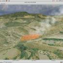
Virtual Terrain Project for Windows 1.1 110804 freeware

... foster the creation of tools for easily constructing any part of the real world in interactive, 3D digital form.

This goal will require a synergetic convergence of the fields of CAD, GIS, visual simulation, surveying and remote sensing. VTP gathers information and tracks progress in areas such as procedural scene construction, feature extraction, and rendering algorithms. ...

Author Ben Discoe
Released 2011-09-08
Filesize 1.00 MB
Downloads 492
OS Windows 2000, Windows 2003, Windows XP, Windows Vista
Installation Instal And Uninstall
Keywords libraries, demos, data, open source, VirtualTerrain Project, CAD, GIS, VTP
Users' rating
(21 rating)
Virtual Terrain Project for WindowsCADWindows 2000, Windows 2003, Windows XP, Windows Vista
Virtual Terrain Project for Windows - any Freeware Download Notice

Virtual Terrain Project for Windows Free Download - we do not host any Virtual Terrain Project for Windows torrent files or links of Virtual Terrain Project for Windows on rapidshare.com, depositfiles.com, megaupload.com etc. All Virtual Terrain Project for Windows download links are direct Virtual Terrain Project for Windows download from publisher site or their selected mirrors.

Virtual Terrain Project for Windows freeware - The Latest User Reviews
Virtual Terrain Project for Windows freeware - The Latest Versions History
1.1 110804 Sep 8, 2011 New Release Enviro:
Exposed support for more stereo modes: Horizontal and Vertical split.
Options to enable joystick and spacenavigator, rather than just always using them if present.
Smooth continuous update when making buildings.
Option to constrain building point to right angles. Deter user from making bad points.
Made support for Collada (.dae) more explicit in the UI.
Display the version number in the startup dialog.
Added 'every N meters' option to Contour dialog, making it significantly more useful.
Changed 'Move' mode to use Alt modifier key for up/down, to be consistent.
Fixed issues with: support for elevation grids with non-unit vertical scale; removing layers from a terrain; saving snapshot and high-resolution snapshot; buildings with a Geographic CRS; draping of 2D polylines on terrain with vertical exaggeration.

VTBuilder:
Raw layers: Draw polygon holes as dotted lines to tell them from outer edges.

Most popular CAD freeware downloads

pCon.planner

8.9.0.100 freeware download

... furnishings and are easily comprehensible. You don`t need any CAD knowledge. The pCon.planner sets new standards in ... panoramas directly onto Facebook - Measuring height of any selected object - Support for the drawing element ...

Panoply for Mac

5.4.3 freeware download

... data on a global or regional map using any of over 200 map projections or make a ... outlines or masks on lon-lat map plots. Use any of numerous color tables for the scale colorbar, ...

EQAlign

2.3.7 freeware download

... distance, etc. You can plan a journal, selecting any object of the database, make your own object comment annotations, etc. Supports many cams as ...

ThermoFlo

2.0.9 freeware download

... expressions and tables to define components properties using any system variable(s) Drag-and-Drop User Interface Simple creation of models by dragging and connecting parts onto the ...

XCircuit

3.8 freeware download

... such as "xfig". It is especially good for any task requiring repeated use of a standard set of graphical objects, including architectural drawing, printed circuit ...

PyMCA

5.5.5 freeware download

... data analysis routines can be used independently of any graphical interface. In addition to data files, PyMca can also access SPEC shared memory to ...

PyMCA for Mac OS X

5.5.5 freeware download

... data analysis routines can be used independently of any graphical interface. In addition to data files, PyMca can also access SPEC shared memory to ...

EnergyRB for Mac OS X

1.0 freeware download

... dimension. The application uses REALbasic's RbScript, so almost any potential energy function can be entered by the user. This function is translated into machine language, ...

RElim x64

4.4 freeware download

... but does its work without prefix trees or any other complicated data structures. The main strength of this algorithm is not its speed (although it ...

CARIS Easy View

4.2.13 freeware download

CARIS Easy View is a simple application that enables you to view spatial data imported from numerous types of files. It allows you to load multiple ...