GGCad Free Edition 2.1.0.5 freeware

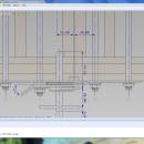
GGCad includes an advanced user interface. It is made up of windows that can be moved, detached at the user's convenience. The size and icon transparency, the font and the colors can be redefined. Workspaces can be saved and loaded. GGCad includes a complete set of tools. It does support quoting, hatches, images, texts. ...

Author GGSoft
Released 2012-11-26
Filesize 21.20 MB
Downloads 577
OS Windows 2000, Windows 2003, Windows XP, Windows Vista, Windows Vista x64, Windows 7, Windows 7 x64
Installation Instal And Uninstall
Keywords g-code generator, CAD viewer, DXF reader, g-code, CAD, DXF
Users' rating
(20 rating)
GGCad Free EditionCADWindows 2000, Windows 2003, Windows XP, Windows Vista, Windows Vista x64, Windows 7, Windows 7 x64
GGCad Free Edition - at t Freeware Download Notice

GGCad Free Edition Free Download - we do not host any GGCad Free Edition torrent files or links of GGCad Free Edition on rapidshare.com, depositfiles.com, megaupload.com etc. All GGCad Free Edition download links are direct GGCad Free Edition download from publisher site or their selected mirrors.

GGCad Free Edition freeware - The Latest User Reviews
GGCad Free Edition freeware - The Latest Versions History
2.1.0.5 Nov 26, 2012 New Release · Crash at startup on new installations.
· Problem in importing DXF when levels are grouped into blocks.
· The default model group was no longer responsible.
2.0.8.5 Jun 15, 2012 New Release · Copy/paste of entities between two GGCad application, including between a 2D document and a 3D document for polyline entities.
· Fast plunge mode for 3D tool path in preferences/CAM
· [a] and [m] key shortcuts while [auto] or [manual] buttons are displayed.
2.0.5.3 Jun 15, 2012 New Release · Copy/paste of entities between two GGCad application, including between a 2D document and a 3D document for polyline entities.
· Fast plunge mode for 3D tool path in preferences/CAM
· [a] and [m] key shortcuts while [auto] or [manual] buttons are displayed.

Most popular CAD freeware downloads

Mini CAD Viewer

3.7.0.0 freeware download

Mini CAD Viewer is a compact free CAD viewer.It is designed to be easy to use, even for those with no prior CAD experience. It allows ...

Myrtle

1.9.0 freeware download

Myrtle Spreadsheet™ is a simple programmable spreadsheet and statistical analysis software specifically designed for learning statistics. It provides the standard spreadsheet functionality one would expect like ...

CiDess

4.28 freeware download

Free PCB Layout editor : - Easy to use - Large number of component types featured - 3D view - User-friendly component types editor - You ...

DipTrace Free

4.3.0.0 freeware download

DipTrace is an advanced PCB design software that consists of 4 modules: PCB Layout, Schematic Capture, Component and Pattern Editors. This EDA tool is a perfect ...

TNTatlas

2024 B20240606 freeware download

TNTatlas is a powerful free geodata viewer that lets you publish and distribute your maps and geospatial data — from a single geodata file to complex ...

QFitsView

8.6 freeware download

SAOImage DS9, developed by Eric Mandel, is a robust and versatile astronomical imaging and data visualization software that has become an indispensable tool for astronomers and ...

primesieve x64

12.3 freeware download

primesieve x64 uses the segmented sieve of Eratosthenes with wheel factorization, this algorithm has a complexity of operations and uses space. Segmentation is currently the ...

TNTmips

20240404 freeware download

TNTmips software is a complete Geographic Information System (GIS) that lets you work with virtually any type of geospatial data including imagery, terrain surfaces, and map ...

TrueSpace

7.61 freeware download

The TrueSpace application was designed to be a fully-featured 3D authoring package that will let you model, texture, light, animate and render 3D content. As well ...

TNTatlas for Mac OS X

2024 B20240508 freeware download

TNTatlas is a powerful free geodata viewer that lets you publish and distribute your maps and geospatial data — from a single geodata file to complex ...