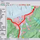
TNTmips for Mac OS X 20240111 freeware

TNTmips is a geospatial image processing tool that allows you to analyze and modify GIS images. It is a professional application that can handle desktop cartography, electronic atlas preparation and spatial database management. ...

Author MicroImages, Inc.
Released 2024-01-11
Filesize 87.90 MB
Downloads 588
OS Mac OS X
Installation Instal And Uninstall
Keywords GIS data analysis, analyze geodetic data, edit GIS dataset, GIS, dataset, editor, analysis, mac os, TNTmips for mac, TNTgis for mac, TNTedit
Users' rating
(42 rating)
TNTmips for Mac OS XCADMac OS X
TNTmips for Mac OS X - complex Freeware Download Notice

TNTmips for Mac OS X Free Download - we do not host any TNTmips for Mac OS X torrent files or links of TNTmips for Mac OS X on rapidshare.com, depositfiles.com, megaupload.com etc. All TNTmips for Mac OS X download links are direct TNTmips for Mac OS X download from publisher site or their selected mirrors.

TNTmips for Mac OS X freeware - The Latest User Reviews
TNTmips for Mac OS X freeware - The Latest Versions History
20240111 Jan 11, 2024 New Release
20230323 Mar 23, 2023 New Release
2022 B202212 Dec 7, 2022 New Release

Most popular CAD freeware downloads

Cytoscape for Mac OS X

3.10.0 freeware download

... research, now it is a general platform for complex network analysis and visualization. Cytoscape core distribution provides a basic set of features for data integration ...

DipTrace Free

4.3.0.0 freeware download

... layer stackup. Smart manual routing tools allow designing complex high-density boards with differential pairs and high-speed data buses and get a working prototype on time. ...

TNTatlas

2024 B20240606 freeware download

... data — from a single geodata file to complex map layouts prepared using TNTmips. TNTatlas lets you display massive sized geodata and will directly display ...

QFitsView

8.6 freeware download

... astronomers and astrophysicists worldwide. Designed to handle the complex demands of astronomical data analysis, DS9 offers a ... data, making it easier to explore and interpret complex datasets. The software's ability to handle large data ...

TNTmips

20240404 freeware download

TNTmips software is a complete Geographic Information System (GIS) that lets you work with virtually any type of geospatial data including imagery, terrain surfaces, and map ...

TNTatlas for Mac OS X

2024 B20240508 freeware download

... data — from a single geodata file to complex map layouts prepared using TNTmips. TNTatlas lets you display massive sized geodata and will directly display ...

ATCalc

4.0 freeware download

Addressed to: People that don't want to make life more difficult than it should be, allowing them to see the numbers they have entered and ...

Graph Streaming

0.7.0.12 freeware download

... we leverage its power to visualize and monitor complex systems or enterprise data in real-time. Moreover, the idea of streaming graph data goes beyond Gephi, ...

Axdea 3D CAD, BIM based IBS Score

1.1.6 freeware download

... more functionality using Python scripts or Macros. Record complex actions and replay for future convenience. 7) Import/Export: STEP, IGES, OBJ, STL, DXF, SVG, STL, DAE, ...

Axdea

1.1.6 freeware download

... more functionality using Python scripts or Macros. Record complex actions and replay for future convenience. 7) Import/Export: STEP, IGES, OBJ, STL, DXF, SVG, STL, DAE, ...