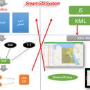
Elshayal Smart 23.02 freeware

Download Maps from Google Earth, and Trace & save GPS route and View and Rectify Raster Images gif, jpg, bmp and Edit shape files, build new layer, add existing layer, remove layers, swap layers, save layer, set layer data source, layer properties, zoom in & zoom out, pan, identify, selecting features, invert selection, show data table, data query builder, location query builder, build network. ...

Author Elshayal Smart Web On Line Software
Released 2023-02-28
Filesize 6.00 MB
Downloads 517
OS Windows Vista, Windows Vista x64, Windows 7, Windows 7 x64, Windows 8, Windows 8 x64, Windows 10, Windows 10 x64
Installation Instal And Uninstall
Keywords edit map, GIS editor, edit GIS, GIS, editor, raster
Users' rating
(13 rating)
Elshayal SmartCADWindows Vista, Windows Vista x64, Windows 7, Windows 7 x64, Windows 8, Windows 8 x64, Windows 10, Windows 10 x64
Elshayal Smart - coordinate Freeware Download Notice

Elshayal Smart Free Download - we do not host any Elshayal Smart torrent files or links of Elshayal Smart on rapidshare.com, depositfiles.com, megaupload.com etc. All Elshayal Smart download links are direct Elshayal Smart download from publisher site or their selected mirrors.

Elshayal Smart freeware - The Latest User Reviews
Elshayal Smart freeware - The Latest Versions History
23.02 Feb 28, 2023 New Release
21.02 Jan 26, 2021 New Release
21.01 Jan 12, 2021 New Release

Most popular CAD freeware downloads

TNTmips for Mac OS X

20240111 freeware download

... variety of data types and a multitude of Coordinate Reference Systems. Include layers in a wide variety ... using a reference image; place control points with coordinates from GPS devices. Import and export an ...

TNTmips

20240404 freeware download

... variety of data types and a multitude of Coordinate Reference Systems. Include layers in a wide variety ... using a reference image; place control points with coordinates from GPS devices ... Import and export ...

Elshayal Smart

23.02 freeware download

... snap vertexes, set vertex XY, move settings, converting coordinate system, applying VB script, copy selected features to another layer, move selected features to another layer, ...

MOPlot

1.93 freeware download

... MOPlot can display: · Geometries, including the Cartesian coordinate axes, atom numbers according to the geometry definition in the calculation. Molecules can be turned in ...

Thuban for Windows

1.2.2 freeware download

... sample collection of projections and the set of coordinate systems as used by the EPSG (European Petroleum Survey Group). For full flexibility projections can ...

Thuban for Mac OS X

1.0.1-3 freeware download

... sample collection of projections and the set of coordinate systems as used by the EPSG (European Petroleum Survey Group). For full flexibility projections can ...

Thuban for Linux

1.2.2 freeware download

... sample collection of projections and the set of coordinate systems as used by the EPSG (European Petroleum Survey Group). For full flexibility projections can ...

wxGIS

0.2.0 freeware download

... interface that is able to store the geographic coordinate systems in folders. It also includes a vector file export utility and a tool for correcting ...

wxGIS Portable

0.4.1 freeware download

... interface that is able to store the geographic coordinate systems in folders. It also includes a vector file export utility and a tool for correcting ...

Java Graticule 3D

3.5.20161106 freeware download

... Gauß-Markov-Model. Moreover, the software supports deformation-analysis. Add-ons are coordinate-transformation (CoordTrans) or the Form-Fitting-Toolbox. Geodetic Network Adjustment Deformation-Analysis Similarity respectively Coordinate Transformation (CoordTrans) FormFitting respectively Form-Analysis (FoormFittingToolbox) Conversion of ...