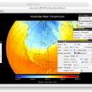
Panoply for Mac 5.4.3 freeware

Panoply for Mac is an utility that enable user to plot raster image. Depending on the data, it can draw global longitude-latitude images or pole-to-pole latitude-vertical images.Panoply is a cross-platform application which plots geo-gridded arrays from netCDF, HDF and GRIB datasets. The utility can also combine two arrays and can project the analysis using more than 100 maps. ...

Author Robert B. Schmunk
Released 2024-06-24
Filesize 36.40 MB
Downloads 951
OS Mac OS X
Installation Instal And Uninstall
Keywords plot raster image, longitude image, pole-to-pole image, raster image, rasterize, raster
Users' rating
(40 rating)
Panoply for MacCADMac OS X
Panoply for Mac - custom a Freeware Download Notice

Panoply for Mac Free Download - we do not host any Panoply for Mac torrent files or links of Panoply for Mac on rapidshare.com, depositfiles.com, megaupload.com etc. All Panoply for Mac download links are direct Panoply for Mac download from publisher site or their selected mirrors.

Panoply for Mac freeware - The Latest User Reviews
Panoply for Mac freeware - The Latest Versions History
5.4.3 Jun 24, 2024 New Release
5.4.1 Jun 1, 2024 New Release
5.4.0 May 11, 2024 New Release

Most popular CAD freeware downloads

Panoply for Mac

5.4.3 freeware download

... and catalogues, to adjust the scale range, to customize labels, vectors, to overlay masks, and so on. ... for the scale colorbar, or apply your own custom ACT, CPT, or RGB color table. Save plots ...

TNTatlas

2024 B20240606 freeware download

... information was with stacks of blueprints or a custom printed atlas or catalog. You have held a paper atlas and browsed its pages of maps, ...

TNTatlas for Mac OS X

2024 B20240508 freeware download

... information was with stacks of blueprints or a custom printed atlas or catalog. You have held a paper atlas and browsed its pages of maps, ...

TNTmips

20240404 freeware download

... SML, provides a wide range of options for custom display and processing of your geospatial data. Construct and transform representations of natural terrains and ...

OpalCalc

1.94 freeware download

... of measures · Currency support with conversion · Custom variables and functions · Programmer syntax and functions · Custom number base support · Advanced notation support ...

GpsTools Studio

2.3.1 build 227 freeware download

... the GpsGate Server users that want to create custom maps in order to use them for tracking the GPS devices. The program allows you to ...

MagicPlot Student for Linux

2.9.3 freeware download

... is disabled here? - Vector image export - Custom fit equations - Data processing - Multiple axes - Color map plots - Figure templates - ...

ThermoFlo

2.0.9 freeware download

... system of other 1D components. Features Custom Complex Math Expressions Complex algebraic math expressions and ... dragging and connecting parts onto the model screen Customizable Parts Modify existing parts or create your own ...

eMachineShop 3D CAD

1.52 freeware download

... and Instant Online Ordering. Now you can design custom parts, select a wide range of machines and materials then simply click to order your custom parts online. Choose from the most popular machining ...

Weather Station Data Logger

5.6.0.0 freeware download

... the maximum number of external wireless temperature/humidity sensors. Custom names can be provided for each sensor and graph colors can be user-defined. Up to ...