Navigation:
- Freeware
- - Graphic Apps
- - CAD
- - TNTatlas
TNTatlas 2024 B20240606 freeware
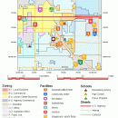
... you publish and distribute your maps and geospatial data — from a single geodata file to complex ... sized geodata and will directly display numerous file formats including shapefiles, GeoTIFF, JP2, PNG, MrSID, DXF, and DWG. ...
| Author | MicroImages, Inc. |
| Released | 2024-06-06 |
| Filesize | 59.00 MB |
| Downloads | 2526 |
| OS | Windows XP, Windows Vista, Windows Vista x64, Windows 7, Windows 7 x64, Windows 8, Windows 8 x64, Windows 10, Windows 10 x64, Windows 11 |
| Installation | Instal And Uninstall |
| Keywords | geospatial viewer, view atlas, visualize geospatial data, atlas, map, viewer |
| Users' rating (77 rating) |
TNTatlas Free Download - we do not host any TNTatlas torrent files or links of TNTatlas on rapidshare.com, depositfiles.com, megaupload.com etc. All TNTatlas download links are direct TNTatlas download from publisher site or their selected mirrors.
| 2024 B202406 | Jun 6, 2024 | New Release | |
| 2022 B202212 | Dec 7, 2022 | New Release | |
| 2022 B202211 | Nov 30, 2022 | New Release |


