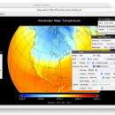
Panoply for Mac 5.4.3 freeware

... user to plot raster image. Depending on the data, it can draw global longitude-latitude images or pole-to-pole ... plots geo-gridded arrays from netCDF, HDF and GRIB datasets. The utility can also combine two arrays and can project the analysis using more than 100 maps. ...

Author Robert B. Schmunk
Released 2024-06-24
Filesize 36.40 MB
Downloads 953
OS Mac OS X
Installation Instal And Uninstall
Keywords plot raster image, longitude image, pole-to-pole image, raster image, rasterize, raster
Users' rating
(40 rating)
Panoply for MacCADMac OS X
Panoply for Mac - data viewer Freeware Download Notice

Panoply for Mac Free Download - we do not host any Panoply for Mac torrent files or links of Panoply for Mac on rapidshare.com, depositfiles.com, megaupload.com etc. All Panoply for Mac download links are direct Panoply for Mac download from publisher site or their selected mirrors.

Panoply for Mac freeware - The Latest User Reviews
Panoply for Mac freeware - The Latest Versions History
5.4.3 Jun 24, 2024 New Release
5.4.1 Jun 1, 2024 New Release
5.4.0 May 11, 2024 New Release

Most popular CAD freeware downloads

Panoply for Mac

5.4.3 freeware download

... plots geo-gridded arrays from netCDF, HDF and GRIB datasets. Panoply is designed to help you view and process the data included in netCDF, HDF, GRIB, and other types ...

TNTatlas

2024 B20240606 freeware download

TNTatlas is a powerful free geodata viewer that lets you publish and distribute your maps and geospatial data — from a single geodata file to complex ...

QGIS for Mac

3.36.1 freeware download

... Software (FOSS). QGIS supports vector, raster, and database formats and lets you browse and create map data on your computer. QGIS supports many common ...

TNTatlas for Mac OS X

2024 B20240508 freeware download

TNTatlas is a powerful free geodata viewer that lets you publish and distribute your maps and geospatial data — from a single geodata file to complex ...

QFitsView

8.6 freeware download

... is a robust and versatile astronomical imaging and data visualization software that has become an indispensable tool ... Designed to handle the complex demands of astronomical data analysis, DS9 offers a comprehensive suite of features ...

QGIS for Linux

3.36.1 freeware download

... Software (FOSS). QGIS supports vector, raster, and database formats and lets you browse and create map data on your computer. QGIS supports many common ...

QGIS

3.36.1 freeware download

... Software (FOSS). QGIS supports vector, raster, and database formats and lets you browse and create map data on your computer. QGIS supports many common ...

MeV

4.9.0 freeware download

MeV or Multiple Experiment Viewer is a Java tool to help you with microarray gene expression data analysis. MeV supports 5 input formats, and provides

ANTz for Linux

2017-01-08 freeware download

... was developed as an interactive and real-time 3D data viewing instrument for the cognizance of complex systems. ... and decision making. Capable of combining stored data with live sources for time sensitive situations. It ...

MeV for Mac OS X

4.8.1 freeware download

MeV or Multiple Experiment Viewer is a Java tool to help you with microarray gene expression data analysis. MeV supports 5 input formats, and provides