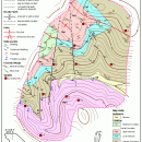
TNTatlas for Mac OS X 2023 B20230323 freeware

TNTatlas is a powerful free geodata viewer that lets you publish and distribute your maps and geospatial data — from a single geodata file to complex map layouts prepared using TNTmips. TNTatlas lets you display massive sized geodata and will directly display numerous file formats including shapefiles, GeoTIFF, JP2, PNG, MrSID, DXF, and DWG. ...

Author MicroImages, Inc.
Released 2023-03-23
Filesize 87.90 MB
Downloads 724
OS Mac OS X
Installation Instal And Uninstall
Keywords geospatial viewer, view atlas, visualize geospatial data, atlas, map, viewer
Users' rating
(42 rating)
TNTatlas for Mac OS XCADMac OS X
TNTatlas for Mac OS X - data viewer Freeware Download Notice

TNTatlas for Mac OS X Free Download - we do not host any TNTatlas for Mac OS X torrent files or links of TNTatlas for Mac OS X on rapidshare.com, depositfiles.com, megaupload.com etc. All TNTatlas for Mac OS X download links are direct TNTatlas for Mac OS X download from publisher site or their selected mirrors.

TNTatlas for Mac OS X freeware - The Latest User Reviews
TNTatlas for Mac OS X freeware - The Latest Versions History
2023 B202303 Mar 23, 2023 New Release
2022 B202212 Dec 7, 2022 New Release
2022 B202211 Nov 30, 2022 New Release

Most popular CAD freeware downloads

Panoply for Mac

5.3.4 freeware download

... plots geo-gridded arrays from netCDF, HDF and GRIB datasets. Panoply is designed to help you view and process the data included in netCDF, HDF, GRIB, and other types ...

QGIS for Mac

3.36.2 freeware download

... Software (FOSS). QGIS supports vector, raster, and database formats and lets you browse and create map data on your computer. QGIS supports many common ...

New Version

QGIS for Linux

3.36.2 freeware download

... Software (FOSS). QGIS supports vector, raster, and database formats and lets you browse and create map data on your computer. QGIS supports many common ...

New Version

QGIS

3.36.2 freeware download

... Software (FOSS). QGIS supports vector, raster, and database formats and lets you browse and create map data on your computer. QGIS supports many common ...

New Version

Panoply

5.3.4 freeware download

... plots geo-gridded arrays from netCDF, HDF and GRIB datasets. Panoply is a cross-platform software application whose purpose ... created with NetCDF, HDF, GEMPACK, GRIB and other datasets, and combine or slice geo-gridded and other types ...

GOM Inspect

7.5 SR1 freeware download

... for dimensional analysis of 3D point clouds and viewer for ATOS and GOM Inspect Professional data sets. Features from GOM Inspect include CAD Data and 3D Point Cloud Import 3D Mesh Processing ...

Qualyzer

1.2.1 freeware download

Qualyzer is a handy, easy to use application designed to support researchers conducting qualitative inquiries by helping them manage participants, transcripts, and memos. ...

CueMol

2.2.3.442 freeware download

... (CCP4, CNS , and BRIX format), MSMS surface data, and GRASP electrostatic potential map. ...

PyRx

0.8 freeware download

... in every step of this process - from data preparation to job submission and analysis of the results. While it is true that ...

Cytoscape x64

3.10.0 freeware download

... with annotations, gene expression profiles and other state data. Although Cytoscape x64 was originally designed for biological ... distribution provides a basic set of features for data integration and visualization. Additional features are available as ...