TatukGIS Viewer 5.85.0.3356 freeware

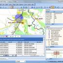
TatukGIS Viewer is a powerful, free GIS application that allows users to visualize, analyze, and edit geospatial data with ease. Designed for both professionals and enthusiasts, it supports a wide range of formats, including vector and raster data. The intuitive interface makes navigation seamless, while advanced features like layer management, spatial analysis tools, and customizable symbology enhance user experience. Ideal for anyone needing robust GIS capabilities without the complexity, Tatu ... ...

Author TatukGIS
Released 2025-04-28
Filesize 175.00 MB
Downloads 686
OS Windows 11, Windows Server 2019, Windows Server 2016, Windows 10 32/64 bit, Windows Server 2012, Windows 2008 32/64 bit, Windows 2003, Windows 8 32/64 bit, Windows 7 32/64 bit, Windows Vista
Installation Instal And Uninstall
Keywords TatukGIS Viewer, raster image Viewer, GIS editor, GIS map, viewer, graphic, view, edit
Users' rating
(55 rating)
TatukGIS ViewerOtherWindows 11, Windows Server 2019, Windows Server 2016, Windows 10 32/64 bit, Windows Server 2012, Windows 2008 32/64 bit, Windows 2003, Windows 8 32/64 bit, Windows 7 32/64 bit, Windows Vista
TatukGIS Viewer - datasets Freeware Download Notice

TatukGIS Viewer Free Download - we do not host any TatukGIS Viewer torrent files or links of TatukGIS Viewer on rapidshare.com, depositfiles.com, megaupload.com etc. All TatukGIS Viewer download links are direct TatukGIS Viewer download from publisher site or their selected mirrors.

TatukGIS Viewer freeware - The Latest User Reviews
TatukGIS Viewer freeware - The Latest Versions History
5.85.0.3356 Apr 28, 2025 New Release Ellipse drawing tool in TGIS_EditorHelper added. EDT-3505
New activation wizard (unified with DK). EDT-3503
Minor fixes & improvements.
5.83.0.3269 Mar 1, 2025 New Release Bugs:
[EDT-3492] Viewer does not start due to a missed license (VWR)
5.88.0.3244 Dec 28, 2024 New Release New features:
CenterByWGS script to center and zoom map based on latitude longitude (EDT,Scripting)
Bugs:
Closing python created form can cause instability (EDT,Python,Scripting)
Wait for external debugger is not reliable (EDT,Python)
Non-modal forms created by Python are sometimes causes AV upon closing. (EDT,Python)
Improvements:
Auto styling of layer and legend reperesantion to be improved. (Core)

Most popular Other freeware downloads

TatukGIS Viewer

5.85.0.3356 freeware download

... for speed and efficiency, capable of handling large datasets and complex analyses without compromising on performance. This makes it an ideal choice for users who ...

Veusz

4.1.0 freeware download

... asset for anyone who needs to visualize complex datasets. At its core, Veusz is built on ... compatibility, combined with its ability to handle large datasets, makes Veusz an ideal choice for professionals dealing ...

New Version

Mkgmap

4922 freeware download

... standout features is its ability to handle large datasets with remarkable efficiency. It supports a wide array ... into Garmin-compatible maps. Its ability to handle large datasets, extensive customization options, and open-source nature make it ...

Pipette

24.8.31 freeware download

"Pipette" is an intuitive and versatile color picker software developed by Stefan Trost. Designed to cater to the needs of graphic designers, web developers, and digital ...

3Depict

0.0.23 freeware download

... was developed to allow for analysis of scientific datasets commonly encountered in atom probe tomography. You can manipulate, interact with and analyse point based datasets. FEATURES: · Fast openGL based ...

Veusz for Linux

3.6.2 freeware download

... external sources Plugin interface for importing data, making datasets or modifying documents ...

PostHole

3.01 freeware download

... The program opens TDS files, which are Posthole datasets that include bitmap scanned images. ...

Veusz for Mac OS X

3.6.2 freeware download

... external sources Plugin interface for importing data, making datasets or modifying documents ...

3Depict for Mac OS X

0.0.13 freeware download

... was developed to allow for analysis of scientific datasets commonly encountered in atom probe tomography. You can manipulate, interact with and analyse point based datasets. FEATURES: · Fast openGL based ...