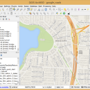
QGIS for Mac 3.36.1 freeware

QGIS supports vector, raster, and database formats and lets you browse and create map data on your computer.
QGIS supports many common spatial data formats (e.g. ESRI ShapeFile, geotiff). QGIS supports plugins to do things like display tracks from your GPS.
QGIS aims to be an easy to use GIS, providing common functions and features. The initial goal was to provide a GIS data viewer. ...

Author Gary Sherman
Released 2024-03-26
Filesize 1600.00 MB
Downloads 781
OS Mac OS X
Installation Instal And Uninstall
Keywords geographic information system, map creator, map viewer, GIS, geographic information, create, QGIS for Mac
Users' rating
(31 rating)
QGIS for MacCADMac OS X
QGIS for Mac - digital Freeware Download Notice

QGIS for Mac Free Download - we do not host any QGIS for Mac torrent files or links of QGIS for Mac on rapidshare.com, depositfiles.com, megaupload.com etc. All QGIS for Mac download links are direct QGIS for Mac download from publisher site or their selected mirrors.

QGIS for Mac freeware - The Latest User Reviews
QGIS for Mac freeware - The Latest Versions History
3.36.1 Mar 26, 2024 New Release
3.36.2 Apr 25, 2024 New Release
3.36.1 Mar 26, 2024 New Release

Most popular CAD freeware downloads

WDSolve

1.0.10 Beta freeware download

... differential equations. WDSolve is based on the Wave Digital method, leading to explicit finite difference schemes with superior stability properties. ...

QGIS for Mac

3.36.1 freeware download

... and graduated) · Display raster data such as digital elevation models, aerial photography or landsat imagery · Change raster symbology (grayscale, pseudocolor and multiband RGB) ...

Caliper2PC

2.7.3.15 freeware download

Lowly priced digital calipers have been available on the market for ... they can be used as position display or Digital Readout DRO for linear axles of small machine ...

VoxelCut

0.4.0 freeware download

Based on voxlap by Ken Silverman, this program shows an empty world in a window, and then lets you call a Python script file called "Run.py" ...

QGIS for Linux

3.36.1 freeware download

... and graduated) · Display raster data such as digital elevation models, aerial photography or landsat imagery · Change raster symbology (grayscale, pseudocolor and multiband RGB) ...

Virtual Terrain Project for Mac OS X and Linux

1.1 110804 freeware download

... part of the real world in interactive, 3D digital form. This goal will require a synergetic convergence of the fields of CAD, GIS, visual ...

JMARS

3.1.5 freeware download

... * Take multiple datasets (thermal inertia, mineral composition, digital elevations, etc.) and overlay them into a single, registered multilayer image. * Make topographic profiles, extract ...

5 freeware award

BrickUtils

0.1.3.0 freeware download

... a simple utility for builders that uses LEGO® Digital Designer™ or LDraw-compatible CAD for designing models. The main problem that BrickUtils tries to solve is ...

Engauge Digitizer for Mac OS X

12.0 freeware download

... The image file can come from a scanner, digital camera or screenshot. The numbers can be read on the screen, and written or copied to ...

5 freeware award

Engauge Digitizer for Linux

12.0 freeware download

... The image file can come from a scanner, digital camera or screenshot. The numbers can be read on the screen, and written or copied to ...