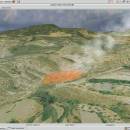
Virtual Terrain Project for Mac OS X and Linux 1.1 110804 freeware

... part of the real world in interactive, 3D digital form.

This goal will require a synergetic convergence of the fields of CAD, GIS, visual simulation, surveying and remote sensing. VTP gathers information and tracks progress in areas such as procedural scene construction, feature extraction, and rendering algorithms. ...

Author Ben Discoe
Released 2011-09-08
Filesize 2.20 MB
Downloads 398
OS Linux, Mac OS X
Installation Instal And Uninstall
Keywords libraries, demos, data, open source, VirtualTerrain Project, CAD, GIS, VTP
Users' rating
(17 rating)
Virtual Terrain Project for Mac OS X and LinuxCADLinux, Mac OS X
Virtual Terrain Project for Mac OS X and Linux - digital Freeware Download Notice

Virtual Terrain Project for Mac OS X and Linux Free Download - we do not host any Virtual Terrain Project for Mac OS X and Linux torrent files or links of Virtual Terrain Project for Mac OS X and Linux on rapidshare.com, depositfiles.com, megaupload.com etc. All Virtual Terrain Project for Mac OS X and Linux download links are direct Virtual Terrain Project for Mac OS X and Linux download from publisher site or their selected mirrors.

Virtual Terrain Project for Mac OS X and Linux freeware - The Latest User Reviews
Virtual Terrain Project for Mac OS X and Linux freeware - The Latest Versions History
1.1 110804 Sep 8, 2011 New Release Enviro:
Exposed support for more stereo modes: Horizontal and Vertical split.
Options to enable joystick and spacenavigator, rather than just always using them if present.
Smooth continuous update when making buildings.
Option to constrain building point to right angles. Deter user from making bad points.
Made support for Collada (.dae) more explicit in the UI.
Display the version number in the startup dialog.
Added 'every N meters' option to Contour dialog, making it significantly more useful.
Changed 'Move' mode to use Alt modifier key for up/down, to be consistent.
Fixed issues with: support for elevation grids with non-unit vertical scale; removing layers from a terrain; saving snapshot and high-resolution snapshot; buildings with a Geographic CRS; draping of 2D polylines on terrain with vertical exaggeration.

VTBuilder:
Raw layers: Draw polygon holes as dotted lines to tell them from outer edges.

Most popular CAD freeware downloads

WDSolve

1.0.10 Beta freeware download

... differential equations. WDSolve is based on the Wave Digital method, leading to explicit finite difference schemes with superior stability properties. ...

DICOMscope

3.5.1 freeware download

... a print server, support for encrypted DICOM communication, digital signatures and structured reporting. DICOMscope is not meant as a competition for commercial DICOM viewers. ...

Virtual Terrain Project for Mac OS X and Linux

1.1 110804 freeware download

... part of the real world in interactive, 3D digital form. This goal will require a synergetic convergence of the fields of CAD, GIS, visual ...

JMARS

3.1.5 freeware download

... * Take multiple datasets (thermal inertia, mineral composition, digital elevations, etc.) and overlay them into a single, registered multilayer image. * Make topographic profiles, extract ...

5 freeware award

VoxelCut

0.4.0 freeware download

Based on voxlap by Ken Silverman, this program shows an empty world in a window, and then lets you call a Python script file called "Run.py" ...

Engauge Digitizer for Mac OS X

12.0 freeware download

... The image file can come from a scanner, digital camera or screenshot. The numbers can be read on the screen, and written or copied to ...

5 freeware award

Engauge Digitizer for Linux

12.0 freeware download

... The image file can come from a scanner, digital camera or screenshot. The numbers can be read on the screen, and written or copied to ...

QGIS for Mac

3.36.1 freeware download

... and graduated) · Display raster data such as digital elevation models, aerial photography or landsat imagery · Change raster symbology (grayscale, pseudocolor and multiband RGB) ...

QGIS for Linux

3.36.1 freeware download

... and graduated) · Display raster data such as digital elevation models, aerial photography or landsat imagery · Change raster symbology (grayscale, pseudocolor and multiband RGB) ...

Marvin Suite

20.20.0 freeware download

... has benefited a lot from the development of digital tools. From simple formula recorders to complicated simulators and analyzers, chemists have a wide range of ...