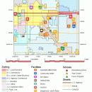
TNTatlas 2024 B20240606 freeware

... you publish and distribute your maps and geospatial data — from a single geodata file to complex map layouts prepared using TNTmips. TNTatlas lets you display massive sized geodata and will directly display numerous file formats including shapefiles, GeoTIFF, JP2, PNG, MrSID, DXF, and DWG. ...

Author MicroImages, Inc.
Released 2024-06-06
Filesize 59.00 MB
Downloads 2498
OS Windows XP, Windows Vista, Windows Vista x64, Windows 7, Windows 7 x64, Windows 8, Windows 8 x64, Windows 10, Windows 10 x64, Windows 11
Installation Instal And Uninstall
Keywords geospatial viewer, view atlas, visualize geospatial data, atlas, map, viewer
Users' rating
(77 rating)
TNTatlasCADWindows XP, Windows Vista, Windows Vista x64, Windows 7, Windows 7 x64, Windows 8, Windows 8 x64, Windows 10, Windows 10 x64, Windows 11
TNTatlas - display data Freeware Download Notice

TNTatlas Free Download - we do not host any TNTatlas torrent files or links of TNTatlas on rapidshare.com, depositfiles.com, megaupload.com etc. All TNTatlas download links are direct TNTatlas download from publisher site or their selected mirrors.

TNTatlas freeware - The Latest User Reviews
TNTatlas freeware - The Latest Versions History
2024 B202406 Jun 6, 2024 New Release
2022 B202212 Dec 7, 2022 New Release
2022 B202211 Nov 30, 2022 New Release

Most popular CAD freeware downloads

Weather Station Data Logger

5.6.0.0 freeware download

This Windows application will display and log weather data obtained through a USB connection to the Oregon ... includes informative discussions on many topics. The display includes most of the data available on the ...

MITO

2.0 freeware download

... MITO provides interaction techniques for manipulating 3D medical data in a virtual environment by 2 DOF input devices. FEATURES: · DICOM compliant · ...

TDSL Personal Edition Portable

1.1.1.40 freeware download

The TDSL (Tube Data Sheet Locator) Personal Edition provides information right on ... all vacuum tube types starting with 6K and display them in the filter window. Simply browse through ...

CARIS Easy View

4.2.13 freeware download

... simple application that enables you to view spatial data imported from numerous types of files. It allows ... order and adjust object parameters. View your spatial data using the free CARIS viewer. CARIS Easy View ...

NetLogo

6.0.4 freeware download

... and controlling agents Export and import functions (export data, save and restore state of model, make a ... BehaviorSpace, an open source tool used to collect data from multiple parallel runs of a model System ...

TNTmips for Mac OS X

20240111 freeware download

... you work with virtually any type of geospatial data including imagery, terrain surfaces, and map data with associated database attributes. It provides all the tools you need ...

Gwyddion

2.66 freeware download

... a modular program for SPM (scanning probe microscopy) data visualization and analysis. Primarily it is intended for ... image analysis, for instance for analysis of profilometry data (learn more about Gwyddion features). Gwyddion is ...

Gwyddion for Linux

2.66 freeware download

... a modular program for SPM (scanning probe microscopy) data visualization and analysis. Primarily it is intended for ... image analysis, for instance for analysis of profilometry data (learn more about Gwyddion features). Gwyddion is ...

QtGrace for Mac OS X

0.2.6 freeware download

... specially designed to offer users a program to display or plot data, analyze data and prepare it for printing. This software is ... automated tasks. FEATURES: · Import numerical data (like scientific measurements, statistics) · Organize and plot ...

MarvinSketch

23.16.0 freeware download

... bonds user can assign stereochemistry to atoms. Additional data fields can also be attached to atoms, via ... valence checker Working with abbreviated groups Image generation, display and formatting ...