QGIS for Mac 3.36.1 freeware

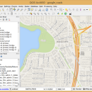
... geotiff). QGIS supports plugins to do things like display tracks from your GPS.
QGIS aims to be an easy to use GIS, providing common functions and features. The initial goal was to provide a GIS data viewer. ...

Author Gary Sherman
Released 2024-03-26
Filesize 1600.00 MB
Downloads 804
OS Mac OS X
Installation Instal And Uninstall
Keywords geographic information system, map creator, map viewer, GIS, geographic information, create, QGIS for Mac
Users' rating
(32 rating)
QGIS for MacCADMac OS X
QGIS for Mac - display Freeware Download Notice

QGIS for Mac Free Download - we do not host any QGIS for Mac torrent files or links of QGIS for Mac on rapidshare.com, depositfiles.com, megaupload.com etc. All QGIS for Mac download links are direct QGIS for Mac download from publisher site or their selected mirrors.

QGIS for Mac freeware - The Latest User Reviews
QGIS for Mac freeware - The Latest Versions History
3.36.1 Mar 26, 2024 New Release
3.36.2 Apr 25, 2024 New Release
3.36.1 Mar 26, 2024 New Release

Most popular CAD freeware downloads

QtGrace for Linux

0.2.6 freeware download

... specially designed to offer users a program to display or plot data, analyze data and prepare it for printing. This software is special because it ...

TNTatlas for Mac OS X

2024 B20240508 freeware download

... map layouts prepared using TNTmips. TNTatlas lets you display massive sized geodata and will directly display numerous file formats including shapefiles, GeoTIFF, JP2, PNG, ...

Gwyddion for Linux

2.66 freeware download

... contrast representation, Canny lines · OpenGL 3D data display: false color or material representation · easily editable color maps and OpenGL materials · basic operations: ...

MicroDicom

2024.2 freeware download

... *.gif, etc) Open and save DICOM directory files Display of patient list from DICOMDIR Display images from different studies or examinations Load via ... and panning DICOM images Medical image processing operation Displaying DICOM attributes of selected image Suited for patient ...

TNTatlas

2024 B20240606 freeware download

... map layouts prepared using TNTmips. TNTatlas lets you display massive sized geodata and will directly display numerous file formats including shapefiles, GeoTIFF, JP2, PNG, ...

MarvinSketch

23.16.0 freeware download

... valence checker Working with abbreviated groups Image generation, display and formatting ...

VariCAD Viewer for Linux

2024 2.01 freeware download

... listed formats. VariCAD viewer offers settings of 3D display methods (like light source or perspective). 3D display can be also exported into high-resolution bitmap file.

QGIS

3.36.1 freeware download

... geotiff). QGIS supports plugins to do things like display tracks from your GPS. QGIS aims to ... layers · Map composer · Identify features · Display attribute table · Select features · Label features ...

QGIS for Mac

3.36.1 freeware download

... geotiff). QGIS supports plugins to do things like display tracks from your GPS. QGIS aims to ... layers · Map composer · Identify features · Display attribute table · Select features · Label features ...

Gwyddion

2.66 freeware download

... contrast representation, Canny lines · OpenGL 3D data display: false color or material representation · easily editable color maps and OpenGL materials · basic operations: ...