Navigation:
AtlasStyler 2.0 Snapshot r201306 freeware
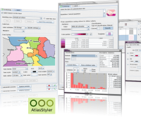
AtlasStyler is designed as an user-friendly and accessible utility to style geodata. The resulting styles can be saved to XML files that follow the OGC SLD/SE standard 1.0. The AtlasStyler is a piece of software that can be used independently for any vector data. ESRI Shapefiles, OGC WFS and PostGIS datasources are supported. ...
| Author | Geopublishing.org |
| Released | 2013-06-04 |
| Filesize | 82 kB |
| Downloads | 304 |
| OS | Windows XP, Windows Vista, Windows Vista x64, Windows 7, Windows 7 x64 |
| Installation | Instal And Uninstall |
| Keywords | geodata styler, style geodata, geodata style, geodata, styler, style |
| Users' rating (9 rating) |
AtlasStyler Free Download - we do not host any AtlasStyler torrent files or links of AtlasStyler on rapidshare.com, depositfiles.com, megaupload.com etc. All AtlasStyler download links are direct AtlasStyler download from publisher site or their selected mirrors.
| 2.0 Snapshot | Jul 3, 2012 | New Release |