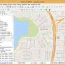
QGIS for Linux 3.36.1 freeware

QGIS supports vector, raster, and database formats and lets you browse and create map data on your computer.
QGIS supports many common spatial data formats (e.g. ESRI ShapeFile, geotiff). QGIS supports plugins to do things like display tracks from your GPS.
QGIS aims to be an easy to use GIS, providing common functions and features. The initial goal was to provide a GIS data viewer. ...

Author Gary Sherman
Released 2024-03-26
Filesize 1.00 MB
Downloads 861
OS Linux
Installation Instal And Uninstall
Keywords geographic information system, map creator, map viewer, GIS, geographic information, create, QGIS for Linux
Users' rating
(46 rating)
QGIS for LinuxCADLinux
QGIS for Linux - edit file Freeware Download Notice

QGIS for Linux Free Download - we do not host any QGIS for Linux torrent files or links of QGIS for Linux on rapidshare.com, depositfiles.com, megaupload.com etc. All QGIS for Linux download links are direct QGIS for Linux download from publisher site or their selected mirrors.

QGIS for Linux freeware - The Latest User Reviews
QGIS for Linux freeware - The Latest Versions History
3.36.1 Mar 26, 2024 New Release
3.36.2 Apr 25, 2024 New Release
3.36.1 Mar 26, 2024 New Release

Most popular CAD freeware downloads

FilterPro Desktop

3.1.0.23446 freeware download

... filter design tool allows designers to create and edit active filter designs easily using the Filter Design ... filters now accounts for passband ripple Supports design file migration from FilterPro v2 so that designs created ...

SketchEl

1.60 freeware download

... limited to the minimum features required to conveniently edit diagram representations of small molecule structures. Toolbars, templates, ... be easily interconverted with the ubiquitous MDL MOL file format, though not not necessarily without information loss. ...

S-Attractor

1.00 freeware download

... number of iterations. The detailed description in the file Read_me!.txt in the catalogue of the program. ...

enCIFer

1.4 freeware download

The Crystallographic Information File (CIF) is the internationally agreed standard file format for information exchange in crystallography. The CIF ... enables users to validate CIFs and ensure their files are format-compliant for deposition with journals and databases ...

enCIFer for Mac OS X

1.4 freeware download

The Crystallographic Information File (CIF) is the internationally agreed standard file format for information exchange in crystallography. The CIF ... enables users to validate CIFs and ensure their files are format-compliant for deposition with journals and databases ...

GstarCAD MC

3.3.1 freeware download

GstarCAD MC enables you to view and edit CAD drawings ( DWG, OCF and DXF files) directly on your mobile device after transferring them. ... DWG, DXF. Various of CAD features such as: Edit, View, Measure, Dimension, Find text, etc. enables you ...

QGIS for Mac

3.36.1 freeware download

... formats support by the OGR library · MapInfo files · GRASS integration, including view, edit, and analysis · On the fly projection of ... and multiband RGB) · Export to Mapserver map file · Digitizing support · Map overview · Plugins ...

QGIS for Linux

3.36.1 freeware download

... formats support by the OGR library · MapInfo files · GRASS integration, including view, edit, and analysis · On the fly projection of ... and multiband RGB) · Export to Mapserver map file · Digitizing support · Map overview · Plugins ...

Portable MicroDicom x64

2024.2 freeware download

... *.bmp, *.gif, etc) Open and save DICOM directory files Display of patient list from DICOMDIR Display images ... images to the most common picture formats, movie file format(.avi) and clipboard Brightness/contrast control Zooming and panning ...

TNTmips for Mac OS X

20240111 freeware download

... all the tools you need to view, create, edit, georeference, interpret, and publish any type of geospatial ... an unsurpassed number of raster, geometric, and database file formats; convert between data types; and link to ...