Br3D 1.3 freeware

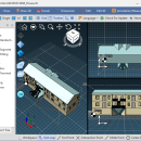
Supports various 3D file format. Read : DWG, DXF, IFC, IFCZIP, STL, STEP, STP, OBJ, LAS, JT, 3DS, IGES, IGS Write : DWG, HTML, STEP, STP, STL, IGES, IGS, PRC, XML Draw Line, Circle, Arc, Text, Multiline Text, Polyline, Spline, Insert Model, Insert Block, Insert Image Draw 3D Box, Cylinder, Cone, Torus, Sphere Terrain Create terrain(by layer, by entity, by grid), Up/Down terrain, Coloring terrain(gradation), Create contour ...

Author HaNee Soft
Released 2022-11-05
Filesize 0 kB
Downloads 126
OS Win2000, Windows XP, Windows 7 x32, Windows 7 x64, Windows 8, Windows 10, WinServer, WinOther, Windows Vista, Windows Vista x64
Installation Install and Uninstall
Keywords DWG, DXF, IFC, IFCZIP, STL, STEP, STP, OBJ, LAS, 3DS, IGES, IGS
Users' rating
(17 rating)
Br3DCADWin2000, Windows XP, Windows 7 x32, Windows 7 x64, Windows 8, Windows 10, WinServer, WinOther, Windows Vista, Windows Vista x64
Br3D - export file Freeware Download Notice

Br3D Free Download - we do not host any Br3D torrent files or links of Br3D on rapidshare.com, depositfiles.com, megaupload.com etc. All Br3D download links are direct Br3D download from publisher site or their selected mirrors.

Br3D freeware - The Latest User Reviews
Br3D freeware - The Latest Versions History
1.3 Nov 5, 2022 Major Update

Most popular CAD freeware downloads

QGIS for Mac

3.36.1 freeware download

... formats support by the OGR library · MapInfo files · GRASS integration, including view, edit, and analysis ... raster symbology (grayscale, pseudocolor and multiband RGB) · Export to Mapserver map file · Digitizing support · ...

QFitsView

8.6 freeware download

... analyzing astronomical images, supporting a wide array of file formats including FITS, which is the standard in ... for remote data access and the ability to export images and analysis results in various formats. This ...

QGIS

3.36.1 freeware download

... formats support by the OGR library · MapInfo files · GRASS integration, including view, edit, and analysis ... raster symbology (grayscale, pseudocolor and multiband RGB) · Export to Mapserver map file · Digitizing support · ...

QGIS for Linux

3.36.1 freeware download

... formats support by the OGR library · MapInfo files · GRASS integration, including view, edit, and analysis ... raster symbology (grayscale, pseudocolor and multiband RGB) · Export to Mapserver map file · Digitizing support · ...

TNTmips

20240404 freeware download

... coordinates from GPS devices ... Import and export an unsurpassed number of raster, geometric, and database file formats; convert between data types; and link to ...

KiCad for Mac OS X

8.0.2 freeware download

... circuits. KiCad allows you to upload NET files and view the selected footprint, record macros, assign hotkeys, and save the generated projects to ZIP file format. Other important options worth mentioning enable ...

FilterPro Desktop

3.1.0.23446 freeware download

... variations; scale passive component values; and view and export filter performance data to Excel. FilterPro ... filters now accounts for passband ripple Supports design file migration from FilterPro v2 so that designs created ...

GpsTools Studio

2.3.1 build 227 freeware download

... to import a map from a popular image file and to export it to a compatible format. The ...

DSI Studio

.59 freeware download

... of passing and/or regions of avoidace. · Supported file format for input ROI: text file, Analyze, NIFTI · Supported file format for output tracts: text file, TrackVis .trk ...

Spirograph

1.0.2.1 freeware download

... toy) · See image creation as animation · Export the created patterns to image file · Save you work for later use · ...