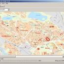
GpsTools Studio 2.3.1 build 227 freeware

... to import a map from a popular image file and to export it to a compatible format. ...

Author Franson Technology
Released 2012-11-21
Filesize 3.80 MB
Downloads 457
OS Windows XP, Windows Vista, Windows Vista x64, Windows 7, Windows 7 x64, Windows 8, Windows 8 x64, Windows 10, Windows 10 x64
Installation Instal And Uninstall
Keywords create map, import GpsGate map, scale image, map, creator, create
Users' rating
(16 rating)
GpsTools StudioCADWindows XP, Windows Vista, Windows Vista x64, Windows 7, Windows 7 x64, Windows 8, Windows 8 x64, Windows 10, Windows 10 x64
GpsTools Studio - export file Freeware Download Notice

GpsTools Studio Free Download - we do not host any GpsTools Studio torrent files or links of GpsTools Studio on rapidshare.com, depositfiles.com, megaupload.com etc. All GpsTools Studio download links are direct GpsTools Studio download from publisher site or their selected mirrors.

GpsTools Studio freeware - The Latest User Reviews
GpsTools Studio freeware - The Latest Versions History
2.3.1 build Nov 21, 2012 New Release

Most popular CAD freeware downloads

KiCad for Mac OS X

8.0.2 freeware download

... circuits. KiCad allows you to upload NET files and view the selected footprint, record macros, assign hotkeys, and save the generated projects to ZIP file format. Other important options worth mentioning enable ...

QFitsView

8.6 freeware download

... analyzing astronomical images, supporting a wide array of file formats including FITS, which is the standard in ... for remote data access and the ability to export images and analysis results in various formats. This ...

TinyCAD

3.00.04 freeware download

... bitmap. TinyCAD supports outputing ciruits diagrams as PNG files. If you are not familar with PNG files, they are the open-source equivilent of GIFs. All modern web browsers and operating systems support PNG files. You can create PNG files directly from ...

QGIS for Linux

3.36.1 freeware download

... formats support by the OGR library · MapInfo files · GRASS integration, including view, edit, and analysis ... raster symbology (grayscale, pseudocolor and multiband RGB) · Export to Mapserver map file · Digitizing support · ...

TNTmips

20240404 freeware download

... coordinates from GPS devices ... Import and export an unsurpassed number of raster, geometric, and database file formats; convert between data types; and link to ...

QGIS for Mac

3.36.1 freeware download

... formats support by the OGR library · MapInfo files · GRASS integration, including view, edit, and analysis ... raster symbology (grayscale, pseudocolor and multiband RGB) · Export to Mapserver map file · Digitizing support · ...

Engauge Digitizer for Windows

12.0 freeware download

... This open source, digitizing software converts an image file showing a graph or map, into numbers. The image file can come from a scanner, digital camera or ...

5 freeware award

Axdea 3D CAD, BIM based IBS Score

1.1.6 freeware download

... Axdea supports the use of Material and IFC file for Building Information Modeling. 3) Spreadsheet: Extract data from the models to spreadsheet and export to CSV format 4) Task Oriented Design: Specific ...

Engauge Digitizer for Mac OS X

12.0 freeware download

... This open source, digitizing software converts an image file showing a graph or map, into numbers. The image file can come from a scanner, digital camera or ...

5 freeware award

QGIS

3.36.1 freeware download

... formats support by the OGR library · MapInfo files · GRASS integration, including view, edit, and analysis ... raster symbology (grayscale, pseudocolor and multiband RGB) · Export to Mapserver map file · Digitizing support · ...