QGIS 3.36.1 freeware

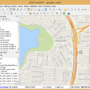
QGIS supports vector, raster, and database formats and lets you browse and create map data on your computer.
QGIS supports many common spatial data formats (e.g. ESRI ShapeFile, geotiff). QGIS supports plugins to do things like display tracks from your GPS.
QGIS aims to be an easy to use GIS, providing common functions and features. The initial goal was to provide a GIS data viewer. ...

Author Gary Sherman
Released 2024-03-26
Filesize 1000.00 MB
Downloads 744
OS Windows XP, Windows Vista, Windows Vista x64, Windows 7, Windows 7 x64, Windows 8, Windows 8 x64, Windows 10, Windows 10 x64, Windows 11
Installation Instal And Uninstall
Keywords geographic information system, map creator, map viewer, GIS, geographic information, create, QGIS
Users' rating
(28 rating)
QGISCADWindows XP, Windows Vista, Windows Vista x64, Windows 7, Windows 7 x64, Windows 8, Windows 8 x64, Windows 10, Windows 10 x64, Windows 11
QGIS - export Freeware Download Notice

QGIS Free Download - we do not host any QGIS torrent files or links of QGIS on rapidshare.com, depositfiles.com, megaupload.com etc. All QGIS download links are direct QGIS download from publisher site or their selected mirrors.

QGIS freeware - The Latest User Reviews
QGIS freeware - The Latest Versions History
3.36.1 Mar 26, 2024 New Release
3.34.4 Feb 28, 2024 New Release
3.34.3 Jan 22, 2024 New Release

Most popular CAD freeware downloads

Panoply for Mac

5.3.4 freeware download

... images or as PDF or PostScript graphics files. Export lon-lat map plots in KMZ format. Export animations as MP4 video or as a collection ...

TNTmips for Mac OS X

20240111 freeware download

... with coordinates from GPS devices. Import and export an unsurpassed number of raster, geometric, and database file formats; convert between data types; and link ...

FilterPro Desktop

3.1.0.23446 freeware download

... variations; scale passive component values; and view and export filter performance data to Excel. FilterPro active filter design tool allows designers to create ...

QGIS for Mac

3.36.1 freeware download

... raster symbology (grayscale, pseudocolor and multiband RGB) · Export to Mapserver map file · Digitizing support · ... QGIS libraries in mapping applications · Improved MapServer export tool · Vector layer transparency and antialiasing · ...

QGIS for Linux

3.36.1 freeware download

... raster symbology (grayscale, pseudocolor and multiband RGB) · Export to Mapserver map file · Digitizing support · ... QGIS libraries in mapping applications · Improved MapServer export tool · Vector layer transparency and antialiasing · ...

TNTmips

20240404 freeware download

... coordinates from GPS devices ... Import and export an unsurpassed number of raster, geometric, and database file formats; convert between data types; and link ...

QGIS

3.36.1 freeware download

... raster symbology (grayscale, pseudocolor and multiband RGB) · Export to Mapserver map file · Digitizing support · ... QGIS libraries in mapping applications · Improved MapServer export tool · Vector layer transparency and antialiasing · ...

Panoply

5.3.4 freeware download

... the beginning of the review and print or export plots to KMZ, GIF, PDF, PNG, PS, AVI ... or as PDF or PostScript graphics files. * Export lon-lat map plots in KMZ format. ...

Sweet Home 3D

7.3 freeware download

... a photorealistic image of the 3D view, and export the plan to SVG format or the 3D ... and textures to customize surfaces. Print and export PDFs, bitmap or vector graphics images, videos and ...

Model Air Design

2.4 freeware download

... in creating airplane model plans. However, it can export a model file that can be used by most CAD programs. The model file can then ...