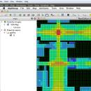
UCL Depthmap 0.8.0 freeware

Depthmap is a single software platform to perform a set of spatial network analyses designed to understand social processes within the built environment. It works at a variety of scales from building through small urban to whole cities or states. ...

Author University College London
Released 2020-11-08
Filesize 35.10 MB
Downloads 1384
OS Windows XP, Windows Vista, Windows Vista x64, Windows 7, Windows 7 x64, Windows 8, Windows 8 x64, Windows 10, Windows 10 x64, Windows 11
Installation Instal And Uninstall
Keywords urban environment, urban map, spatial network analysis, environment, map, analysis
Users' rating
(28 rating)
UCL DepthmapCADWindows XP, Windows Vista, Windows Vista x64, Windows 7, Windows 7 x64, Windows 8, Windows 8 x64, Windows 10, Windows 10 x64, Windows 11
UCL Depthmap - export Freeware Download Notice

UCL Depthmap Free Download - we do not host any UCL Depthmap torrent files or links of UCL Depthmap on rapidshare.com, depositfiles.com, megaupload.com etc. All UCL Depthmap download links are direct UCL Depthmap download from publisher site or their selected mirrors.

UCL Depthmap freeware - The Latest User Reviews
UCL Depthmap freeware - The Latest Versions History
0.8.0 Nov 8, 2020 New Release General:
Allow for pushing values from shapemaps (axial maps, segment maps) to VGA
Fix VGA map connections export
Make drawing to segment conversion faster
Test and fix shape removal for axial and data maps
Allow pushing the Ref or Key value to another layer
Fix MIF/MID import (allow for empty columns, PR #369)
Fix diagonal line handling on VGA map fill (PR #326, thanks Piotr Piastucki!)
Change C++ standard to 17
Graphical User Interface (GUI):
Highlight shapes and pixels on hover (can be disabled in the settings)
Allow inserting any number in the table (PR #356)
Fix a case where the app would crash with multiple unlinking in VGA (PR #328)
Fix convex map hover and selection (PR #368)
Allow generating multiple isovists by importing a CSV file
Fix a case where VGA progress bar would end, but analysis would still be going (PR #323)
0.7.0 Jun 7, 2019 New Release
0.30 Sep 18, 2014 New Release

Most popular CAD freeware downloads

Panoply for Mac

5.4.3 freeware download

... images or as PDF or PostScript graphics files. Export lon-lat map plots in KMZ format. Export animations as MP4 video or as a collection ...

QtGrace for Linux

0.2.6 freeware download

... Add labels, decorations and comments · Save, print, export your results (for example for scientific publications, homework) ...

Gwyddion for Linux

2.66 freeware download

... profile extraction, measuring distances in profile graph, profile export · filtering: mean, median, conservative denoise, Kuwahara, minimum, maximum, checker pattern removal · general convolution filter ...

QGIS for Mac

3.36.1 freeware download

... raster symbology (grayscale, pseudocolor and multiband RGB) · Export to Mapserver map file · Digitizing support · ... QGIS libraries in mapping applications · Improved MapServer export tool · Vector layer transparency and antialiasing · ...

Gwyddion

2.66 freeware download

... profile extraction, measuring distances in profile graph, profile export · filtering: mean, median, conservative denoise, Kuwahara, minimum, maximum, checker pattern removal · general convolution filter ...

QFitsView

8.6 freeware download

... for remote data access and the ability to export images and analysis results in various formats. This feature is particularly valuable for research teams spread ...

QGIS

3.36.1 freeware download

... raster symbology (grayscale, pseudocolor and multiband RGB) · Export to Mapserver map file · Digitizing support · ... QGIS libraries in mapping applications · Improved MapServer export tool · Vector layer transparency and antialiasing · ...

QGIS for Linux

3.36.1 freeware download

... raster symbology (grayscale, pseudocolor and multiband RGB) · Export to Mapserver map file · Digitizing support · ... QGIS libraries in mapping applications · Improved MapServer export tool · Vector layer transparency and antialiasing · ...

TNTmips

20240404 freeware download

... coordinates from GPS devices ... Import and export an unsurpassed number of raster, geometric, and database file formats; convert between data types; and link ...

KiCad for Mac OS X

8.0.2 freeware download

... mode. Plus the PCBs can be printed or exported to DSN, CAD, or WRL. FEATURES ... a 2D display. Eeschema Features: Electrical Rules Check Export Netlists Bill Of Materials Integrated libraries PcbNew Features: ...