TNTmips 20240404 freeware

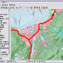
TNTmips is a geospatial image processing tool that allows you to analyze and modify GIS images. It is a professional application that can handle desktop cartography, electronic atlas preparation and spatial database management. ...

Author MicroImages, Inc.
Released 2024-04-04
Filesize 121.00 MB
Downloads 1732
OS Windows XP, Windows Vista, Windows Vista x64, Windows 7, Windows 7 x64, Windows 8, Windows 8 x64, Windows 10, Windows 10 x64, Windows 11
Installation Instal And Uninstall
Keywords GIS data analysis, analyze geodetic data, edit GIS dataset, GIS, dataset, editor, analysis
Users' rating
(121 rating)
TNTmipsCADWindows XP, Windows Vista, Windows Vista x64, Windows 7, Windows 7 x64, Windows 8, Windows 8 x64, Windows 10, Windows 10 x64, Windows 11
TNTmips - file analysis Freeware Download Notice

TNTmips Free Download - we do not host any TNTmips torrent files or links of TNTmips on rapidshare.com, depositfiles.com, megaupload.com etc. All TNTmips download links are direct TNTmips download from publisher site or their selected mirrors.

TNTmips freeware - The Latest User Reviews
TNTmips freeware - The Latest Versions History
20240404 Apr 4, 2024 New Release
20240131 Jan 31, 2024 New Release
20240108 Jan 8, 2024 New Release

Most popular CAD freeware downloads

Cytoscape for Mac OS X

3.10.0 freeware download

... it is a general platform for complex network analysis and visualization. Cytoscape core distribution provides a basic ... network and molecular profiling analyses, new layouts, additional file format support, scripting, and connection with databases. Plugins ...

QFitsView

8.6 freeware download

... to handle the complex demands of astronomical data analysis, DS9 offers a comprehensive suite of features that ... analyzing astronomical images, supporting a wide array of file formats including FITS, which is the standard in ...

TNTmips

20240404 freeware download

... an unsurpassed number of raster, geometric, and database file formats; convert between data types; and link to ... formats including GeoTIFF, JPEG2000, PNG, MrSID, ECW, shapefile, File Geodatabase, Oracle Spatial, DGN, TAB, DXF, DWG ... ...

QGIS for Linux

3.36.1 freeware download

... formats support by the OGR library · MapInfo files · GRASS integration, including view, edit, and analysis · On the fly projection of vector layers ... and multiband RGB) · Export to Mapserver map file · Digitizing support · Map overview · Plugins ...

QGIS for Mac

3.36.1 freeware download

... formats support by the OGR library · MapInfo files · GRASS integration, including view, edit, and analysis · On the fly projection of vector layers ... and multiband RGB) · Export to Mapserver map file · Digitizing support · Map overview · Plugins ...

QGIS

3.36.1 freeware download

... formats support by the OGR library · MapInfo files · GRASS integration, including view, edit, and analysis · On the fly projection of vector layers ... and multiband RGB) · Export to Mapserver map file · Digitizing support · Map overview · Plugins ...

SDMetrics

2.5 freeware download

... SDMetrics with reverse engineering tools that produce XMI files from C++, Java, Delphi, or Smalltalk source code, ... potential when they are subjected to powerful statistical analysis procedures. SDMetrics exports measurement data and descriptive statistics ...

Weather Station Data Logger

5.6.0.0 freeware download

... most of the data available on the console, analysis of wind and temperature data plus graphs of ... time. Data is also logged to a CSV file with options for automatic backup and trimming. Daily ...

OpenRocket

14.06 freeware download

... of components or stages separately Simulation and analysis Full six degree of freedom simulation Rocket ... computed using extended Barrowman method Realistic wind modeling Analysis of the effect of separate components on the ...

GOM Inspect

7.5 SR1 freeware download

... 3D inspection and mesh processing software for dimensional analysis of 3D point clouds and viewer for ATOS ... Import 3D Mesh Processing 3D Inspection Tools 2D Analysis Comprehensive Reporting Data Export Extensive, certified inspection ...