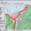
TNTmips 20240404 freeware

TNTmips is a geospatial image processing tool that allows you to analyze and modify GIS images. It is a professional application that can handle desktop cartography, electronic atlas preparation and spatial database management. ...

Author MicroImages, Inc.
Released 2024-04-04
Filesize 121.00 MB
Downloads 1646
OS Windows XP, Windows Vista, Windows Vista x64, Windows 7, Windows 7 x64, Windows 8, Windows 8 x64, Windows 10, Windows 10 x64, Windows 11
Installation Instal And Uninstall
Keywords GIS data analysis, analyze geodetic data, edit GIS dataset, GIS, dataset, editor, analysis
Users' rating
(116 rating)
TNTmipsCADWindows XP, Windows Vista, Windows Vista x64, Windows 7, Windows 7 x64, Windows 8, Windows 8 x64, Windows 10, Windows 10 x64, Windows 11
TNTmips - file control Freeware Download Notice

TNTmips Free Download - we do not host any TNTmips torrent files or links of TNTmips on rapidshare.com, depositfiles.com, megaupload.com etc. All TNTmips download links are direct TNTmips download from publisher site or their selected mirrors.

TNTmips freeware - The Latest User Reviews
TNTmips freeware - The Latest Versions History
20240404 Apr 4, 2024 New Release
20240131 Jan 31, 2024 New Release
20240108 Jan 8, 2024 New Release

Most popular CAD freeware downloads

MOPlot

1.93 freeware download

... can be turned in all directions under mouse control, or, for more precision, using the controls in the "camera" menu. Bonds can be displayed ... optimization can be displayed and saved to a file. · Form linear combinations of vibrations. This feature ...

OpenDCL Studio

9.1.5.2 freeware download

... limited DCL. They can replace the Dialog Control Language with a rich set of modern Windows user interface elements. ...

SeiSee

2.22.6 freeware download

... analyze the data about earthquakes stored in SEG-Y files. The program can also view the content of CWP, CGG and CST files in order to examine the data.You can use ...

CARIS Easy View

4.2.13 freeware download

... view spatial data imported from numerous types of files. It allows you to load multiple layers, change ... view spatial data from a wide range of file types without the need for specialized software. ...

TNTmips for Mac OS X

20240111 freeware download

... ArcIMS. Automatically generate hundreds to thousands of control points using a reference image of the same ... overlay display modes using a reference image; place control points with coordinates from GPS devices. Import ...

MicroDicom

2024.2 freeware download

... *.bmp, *.gif, etc) Open and save DICOM directory files Display of patient list from DICOMDIR Display images ... images to the most common picture formats, movie file format(.avi) and clipboard Brightness/contrast control Zooming and panning ...

MicroDicom x64

2024.2 freeware download

... *.bmp, *.gif, etc) Open and save DICOM directory files Display of patient list from DICOMDIR Display images ... images to the most common picture formats, movie file format(.avi) and clipboard Brightness/contrast control Zooming and panning ...

SketchEl

1.60 freeware download

... be easily interconverted with the ubiquitous MDL MOL file format, though not not necessarily without information loss. ... based, with features for interconverting with MDL SD files. All of the SketchEl features are written ...

X-Sweet Home 3D

4.4 [rev18] freeware download

... videos with the ability to customize lights and control sunlight effect according to the time of day ... bitmap or vector graphics images, videos and 3D files in standard file formats · Extend the features ...

QFitsView

8.6 freeware download

... analyzing astronomical images, supporting a wide array of file formats including FITS, which is the standard in ... options, color maps, and region definitions, enabling precise control over how data is presented. This flexibility is ...