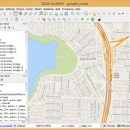
QGIS for Linux 3.36.1 freeware

QGIS supports vector, raster, and database formats and lets you browse and create map data on your computer.
QGIS supports many common spatial data formats (e.g. ESRI ShapeFile, geotiff). QGIS supports plugins to do things like display tracks from your GPS.
QGIS aims to be an easy to use GIS, providing common functions and features. The initial goal was to provide a GIS data viewer. ...

Author Gary Sherman
Released 2024-03-26
Filesize 1.00 MB
Downloads 823
OS Linux
Installation Instal And Uninstall
Keywords geographic information system, map creator, map viewer, GIS, geographic information, create, QGIS for Linux
Users' rating
(44 rating)
QGIS for LinuxCADLinux
QGIS for Linux - file copy Freeware Download Notice

QGIS for Linux Free Download - we do not host any QGIS for Linux torrent files or links of QGIS for Linux on rapidshare.com, depositfiles.com, megaupload.com etc. All QGIS for Linux download links are direct QGIS for Linux download from publisher site or their selected mirrors.

QGIS for Linux freeware - The Latest User Reviews
QGIS for Linux freeware - The Latest Versions History
3.36.1 Mar 26, 2024 New Release
3.36.2 Apr 25, 2024 New Release
3.36.1 Mar 26, 2024 New Release

Most popular CAD freeware downloads

QGIS for Linux

3.36.1 freeware download

... formats support by the OGR library · MapInfo files · GRASS integration, including view, edit, and analysis ... and multiband RGB) · Export to Mapserver map file · Digitizing support · Map overview · Plugins ...

TinyCAD

3.00.04 freeware download

... can use TinyCAD to publish your drawings by copying and pasting into a Word document or saving ... bitmap. TinyCAD supports outputing ciruits diagrams as PNG files. If you are not familar with PNG files, ...

Engauge Digitizer for Mac OS X

12.0 freeware download

... This open source, digitizing software converts an image file showing a graph or map, into numbers. The image file can come from a scanner, digital camera or ...

5 freeware award

Engauge Digitizer for Linux

12.0 freeware download

... This open source, digitizing software converts an image file showing a graph or map, into numbers. The image file can come from a scanner, digital camera or ...

GstarCAD MC

3.3.1 freeware download

... edit CAD drawings ( DWG, OCF and DXF files) directly on your mobile device after transferring them. ... There is no limit to how large the file is. • Fully compatibility with AutoCAD. (2) No ...

QGIS

3.36.1 freeware download

... formats support by the OGR library · MapInfo files · GRASS integration, including view, edit, and analysis ... and multiband RGB) · Export to Mapserver map file · Digitizing support · Map overview · Plugins ...

QGIS for Mac

3.36.1 freeware download

... formats support by the OGR library · MapInfo files · GRASS integration, including view, edit, and analysis ... and multiband RGB) · Export to Mapserver map file · Digitizing support · Map overview · Plugins ...

EnCalc

4.2 freeware download

... favorite calculator! Simple installation program, or just copy the folder and run the program direct. Uninstall ... folder and whatever shortcuts you've created. No system files, no .dll's, no add/spyware, and no registry changes. ...

FONZIE

12.2010 freeware download

... (i.e., occurrence of the marker as a single copy in the genome) using BLAST2.0, 5) design minisatellite ... PCR product by BLAST. A final file returns to users all the results required to ...

Pro Yacht

1.0.0.1 freeware download

... the hull surface can be generated or hard copy templates printed, to scale, to aid physical modelling. ... analysis. For the expert designer, the native text file format can be used to overlay flow lines ...