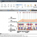
ZWCAD Viewer 2017 freeware

Free ZWCAD Viewer for CAD DWG File Viewing and Plotting. ZWCAD Viewer runs on different ... be viewed in all kinds of frequently used file formats like dwg, dwf, dwfx, dxf and dwt. ZWCAD Viewer is able to measure distance between objects, area of a closed shape, mass and volume of a 3D model, regions or coordinates on the drawings. ...

Author ZWCAD Design Co., Ltd
Released 2016-03-28
Filesize 161.95 MB
Downloads 350
OS Win2000, Windows XP, Windows 7 x32, Windows 7 x64, Windows 8, Windows 10, WinServer, WinOther, Windows Vista, Windows Vista x64
Installation Install and Uninstall
Keywords ZWCAD, DWG CAD, DWG Viewer, AutoCAD free download, free download CAD, AutoCAD, PDF print, PDF plotting
Users' rating
(22 rating)
ZWCAD ViewerCADWin2000, Windows XP, Windows 7 x32, Windows 7 x64, Windows 8, Windows 10, WinServer, WinOther, Windows Vista, Windows Vista x64
ZWCAD Viewer - file i o Freeware Download Notice

ZWCAD Viewer Free Download - we do not host any ZWCAD Viewer torrent files or links of ZWCAD Viewer on rapidshare.com, depositfiles.com, megaupload.com etc. All ZWCAD Viewer download links are direct ZWCAD Viewer download from publisher site or their selected mirrors.

ZWCAD Viewer freeware - The Latest User Reviews
ZWCAD Viewer freeware - The Latest Versions History
2017 Mar 28, 2016 New Release Open DWG, DXF, DWF and DWT file formats from version R12 to 2013
Smaller and quicker And it is the interface you are familiar with
Still be free for all following versions
View both 2D objects and 3D models
Zoom and pan, 3D Orbit helps you view with ease
View 3D models in hide mode
View proxy

Most popular CAD freeware downloads

Gmsh

4.13.1 freeware download

... translate, rotate, scale), physical groups (coherence, reload, edit file), define one, two and three dimensions, as well ... the graphical user interface or in ASCII text files using Gmsh's own scripting language. The tool does ...

Mini CAD Viewer

3.7.0.0 freeware download

... supports DWG, DWF, DXF formats. It allows drawing file to be printed. ...

MicroDicom

2024.2 freeware download

... *.bmp, *.gif, etc) Open and save DICOM directory files Display of patient list from DICOMDIR Display images ... images to the most common picture formats, movie file format(.avi) and clipboard Brightness/contrast control Zooming and panning ...

VariCAD Viewer for Linux

2024 2.01 freeware download

... 2D DWG, DXF, 3D STEP and 2D/3D VariCAD file formats. VariCAD viewer allows you to convert DWG ... display can be also exported into high-resolution bitmap file. ...

QGIS

3.36.1 freeware download

... formats support by the OGR library · MapInfo files · GRASS integration, including view, edit, and analysis ... and multiband RGB) · Export to Mapserver map file · Digitizing support · Map overview · Plugins ...

QGIS for Mac

3.36.1 freeware download

... formats support by the OGR library · MapInfo files · GRASS integration, including view, edit, and analysis ... and multiband RGB) · Export to Mapserver map file · Digitizing support · Map overview · Plugins ...

TNTatlas for Mac OS X

2024 B20240508 freeware download

... and geospatial data — from a single geodata file to complex map layouts prepared using TNTmips. TNTatlas ... massive sized geodata and will directly display numerous file formats including shapefiles, GeoTIFF, JP2, PNG, MrSID, DXF, ...

MicroDicom x64

2024.2 freeware download

... *.bmp, *.gif, etc) Open and save DICOM directory files Display of patient list from DICOMDIR Display images ... images to the most common picture formats, movie file format(.avi) and clipboard Brightness/contrast control Zooming and panning ...

QFitsView

8.6 freeware download

... analyzing astronomical images, supporting a wide array of file formats including FITS, which is the standard in the field. Its intuitive interface allows users to ...

TNTatlas

2024 B20240606 freeware download

... and geospatial data — from a single geodata file to complex map layouts prepared using TNTmips. TNTatlas ... massive sized geodata and will directly display numerous file formats including shapefiles, GeoTIFF, JP2, PNG, MrSID, DXF, ...